Seas Island
pp. 28-29 · Read in the full issue
A New South
Is Born...
ANEW volcanic island, belching fire, steam and molten rock, was born in the western waters of Tonga early in December.
The new island is on a notorious line of weakness in the earth’s crust that begins at Mt. Ruapehu in the North Island of New Zealand and runs to Savaii, Western Samoa.
The line runs through the Tongan islands of Ata, Hunga Tonga, Hunga Ha’apai, Falcon Island, Tofua, Kao, Metis Shoal and Late.
The new island has appeared on Metis Shoal, about 30 miles north-north-east of Kao, where an island previously existed about 70 years ago.
It was first seen as a glow in the sky about 9 p.m. on December 12 by Captain Peter Bennett, of the MV Tofua. Thinking that it was a ship on fire, Captain Bennett changed course and headed for it.
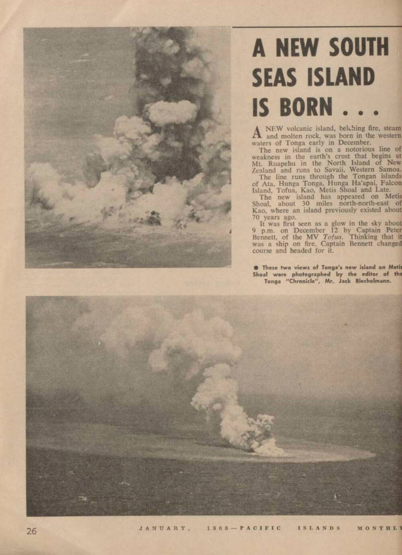
• These two views of Tonga's new island on Metis Shoal were photographed by the editor of the Tonga "Chronicle", Mr. Jack Riechelmann.
However, from a distance of 13 miles he could see that it was a volcanic eruption. The new island that had been thrown up appeared to be about half a mile long and 150 ft high; but lava was erupt ing to a height of about 4,000 ft and smoke and steam were billow ing even higher.
Two days after the eruption was reported, Tonga’s King Taufa’ahau, the British Consul, Mr. A. C. Reid, senior Tongan Government officials, and Press men flew over the new island in a chartered Fiji Airways Heron aircraft.
The Heron approached the new island at a tentative 3,000 ft, and dropped to 1,200 after some trial circuits.
One of the Pressmen aboard, Mr. Alf Sanft, of radio station ZCO Nukualofa, described the mass of rock and ash as “no more than 100 yards across, and rising to approximately 50 ft”.
He said it was “not a solid cone, but rather a fearful jagged grey outcrop”, which was “boil ing at the base like a giant cauldron as the force of steam and debris clashed with the wash of the waves”.
Great columns of steam and rock were being hurled 1,200 ft into the sky at intervals of 10 to 15 seconds.
“We saw no glow of lava,” Mr.
Sanft reported, “but possibly the brilliant tropical sunshine and the thick billowing mass of grey black steam and smoke dissipated the light of what might be a brilliant inferno by night.”
Mr. Sanft added: “At the apex of each bursting convulsion the wind caught the mushrooming condensation and swept it upwards and away to a distance of 3,000
to 4,000 ft. Looking at this strange phenomenon from up wind was like watching a giant moving staircase escalating into the sky”.
Officials in Tonga believe that the new island is in the same position as that reported by HMS Metis in 1875 as being 29 ft high.
The same island was seen three years later by HMS Sappho and was then about 200 yards long and 110 ft high. It was emitting white smoke and was reported to be covered with sulphur.
The island was still active in 1886 and was said to be 151 ft high in 1890. But by 1898, it had two fathoms of water over it.
The reappearance of the island in December occurred: • About two weeks after a massive landslide on Ofu island in the Manu’a Group of American Samoa on November 25. • About two weeks before a series of earth tremors which shook Rabaul for about 30 seconds on December 25.
AS Tonga’s new volcanic island was rising to the surface, the New Guinea Government Gazette was formally announcing the end of a legal dispute over ownership of land at Rabaul thrown out of the sea in a volcanic eruption 30 years ago. The new land will go to the local natives.
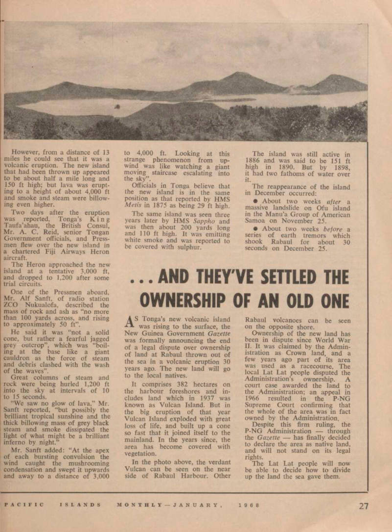
It comprises 382 hectares on the harbour foreshores and in cludes land which in 1937 was known as Vulcan Island. But in the big eruption of that year Vulcan Island exploded with great loss of life, and built up a cone so fast that it joined itself to the mainland. In the years since, the area has become covered with vegetation.
In the photo above, the verdant Vulcan can be seen on the near side of Rabaul Harbour. Other
Rabaul volcanoes can be seen on the opposite shore.
Ownership of the new land has been in dispute since World War 11. It was claimed by the Admin istration as Crown land, and a few years ago part of its area was used as a racecourse. The local Lat Lat people disputed the Administration’s ownership. A court case awarded the land to the Administration; an appeal in 1966 resulted in the P-NG Supreme Court confirming that the whole of the area was in fact owned by the Administration.
Despite this firm ruling, the P-NG Administration through the Gazette has finally decided to declare the area as native land, and will not stand on its legal rights.
The Lat Lat people will now be able to decide how to divide up the land the sea gave them.