Kutubu
pp. 54-55 · Read in the full issue
Come in to Kutubu
With Captain Hugh M. Birch, DFC, of QEA.
JN the twenties and the thirties Karius, Hides, O'Malley, the Champion brothers and others pushed laboriously into unknown Papua by canoe or on foot. Their journeys took weeks; sometimes many months. Danger lurked around the twists and bends of the long rivers; in the plateaux and mountains of the interior. Illness, and sometimes death, were often the only reward.
But they put upon the map and into our minds such names as the Strickland River, the Purari, Kikori, the Fly, Lake Murray, Lake Kutubu and the rest.
To-day these incredible journeys that took them months may be accomplished, at ease, during the daylight hours of only one day. This is the story.
rpHE Qantas Catalina service which i. crosses the Gulf of Papua departs from Port Moresby every alternate Monday. It is a fascinating run, so come with me on the westbound.
At 6.30 a.m. we leave the water, bound for Yule Island, a small Government Station and the headquarters of the Roman Catholic Mission, Papua, about 60 miles from Moresby. Our course takes us over Oroi, one of the drilling sites of the Australian Petroleum Co., oil der ricks glistening in the early morning sun; and then, at 7 a.m., we land at Yule.
Canoes are alongside in no time, our
passengers disembark and the cargo is unloaded. Within 15 minutes we are air borne again and winging our way to Kerema.
Our aircraft is a Catalina flying-boat named, appropriately, Island Chieftain. It was converted to a passenger-cum freighter in the QEA workshops at Rose Bay, Sydney. Our cargo—just about as varied as one could imagine. We have 17 passengers, three fowls, 200 chickens, a dog, two cats and 850 lb. of frozen meat.
It is 8 a.m. and Kerema is below.
Kerema is a small Government Station
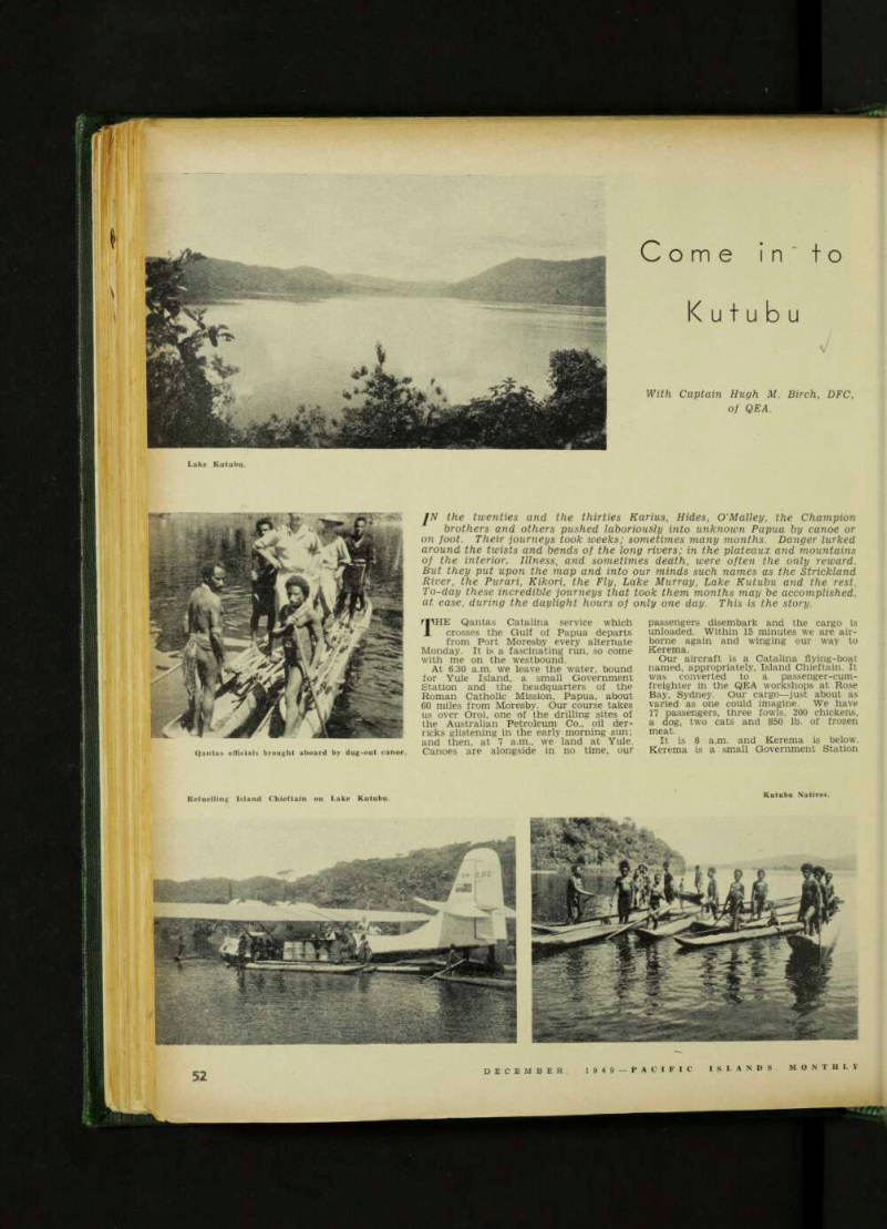
Lake Kutubu.
Qantas officials brought aboard by dug-out canoe.
Kutubu Natives.
Refuelling Island Chieftain on Lake Kutubu.
on Freshwater Bay; it is a centre for copra, cocoa and rubber plantations. Here we are met by the Assistant District Officer, in a whale boat. He signs for the mail, two more passengers disem bark and again we are on our way.
Off to the north, towering peaks of the Owen Stanleys are still clear in the morning air. Later they will disappear, shrouded in the cumulus clouds so familiar to all New Guinea pilots.
We now near the top of the mighty Gulf and our course takes us over the winding rivers and flats of the Delta country. This, a crocodile infested swampy area, described on the map as “a tortuous maze of navigable rivers and streams,” is not much good for any thing. Few live here except the hardy river natives whose sole means of trans port is the dug-out canoe.
It is on one of the many Delta streams that we find our next port of call— Kikori on the Kikori River. It is about 20 miles upstream, and one of the wet test places in the world. It has an average rainfall of nearly 300 inches, most of it falling between April and September. Ten inches in one day is not an abnormal fall.
Through the misty rain we can see the river winding below—a swiftly flow ing stream with many logs floating down stream. We circle the Station and come down on to the river. Kikori is the District Headquarters for the Delta Division of Papua and the natives of this area were well known, not so long ago, for their cannibalistic tendencies.
Those days have now passed and it would be difficult to find a more peaceful spot.
Here we take on 4,000 lb. of cargo for Lake Kutubu, 90 miles inland and to the north-west in the direction of the Central Highlands. We leave Kikori and commence the long climb over the ranges levelling out at 7,000 ft. On our left is the Great Papuan Plateau, a series of limestone ridges and valleys, varying in height from 2,000 to 4 000 feet. From this Plateau rises Mt. Bosari—a volcano, 9.500 ft. high, its peak wreathed in clouds.
Now below are Beaver’s Falls, a mag nificent torrent falling vertically for over 300 feet. This is the Mubi River which has its source not far from our desti nation. Lake Kutubu, 2,600 ft. above sea level is of volcanic origin and very deep. It is nearly 11 miles long and varies in width from U to 2 miles.
Through a hole in the clouds we can see it ahead, deep blue and so calm that the clouds are reflected on its sur face. We gradually descend onto its waters and are soon surrounded by the local tribesmen—fierce looking warriors each with a bone piercing his nose. This base was opened up by the Qantas Cata lina onlv a few months ago. Our journey from Kikori by the Island Chieftain has taken 45 minutes—to walk it the record is 56 days.
In charge of the Government Post here are a young Assistant District Officer and a Patrol Officer whose duty it is to bring these native people under control, learn their customs and strange language the surrounding country.
Kutubu is a beautiful place surrounded by mountains covered with jungle right to the waters edge.
WE still have 460 miles to go before our night stop, so as soon as the cargo is unloaded we are off once more, our next call Lake Murray, in the great Fly River valley. We cross the nmestone plateau again, passing Mount Bosari and Lake Campbell, a small vol canic lake named after Group-Captain Stuart Campbell, a pioneer aviator in
these parts and more recently leader of an Australian expedition to the Antarc tic.
Then gradually the plateau drops away to flat and swampy river country. We cross the Strickland River and soon we see Lake Murray, which is a 7 most an inland sea, nearly 30 miles long. We are now only 12 miles from the Dutch New Guinea Border and one of the duties of the lonely Patrol Officer stationed here is to patrol that Border. His is a solitary life with no other white men for at least 100 miles. His pleasure at seeing us can be imagined. He has a yarn for half an hour, receives h’s mail and stores, and then we are gone. Without an air service to this Lake, the only link with civilisation is a boat trip of over 500 miles down the Lake and then into the Strickland River and thence down the Flv to Daru. About a month is the usual time for this voyage. We take U hours.
Daru is a flat, damn and rather de pressing place with little to recommend it. Once it was a haven for pearling luggers from Thursday Island, but few come here now. We do not tarry long: it is the end of our Western run. but Kikori is where we usually spend the night, so off we go with half a dozen passengers to Kikori.
It is 5 p.m. when we touch down again on those muddv swirling waters after eight hundred miles of flying since 6.30 a.m. with seven stops. The Captain and his crew are glad to get ashore for the first time in nearly 11 hours. Night falls quickly on Kikori: dinner is waiting: we give bur hosts the latest news from Moresey—it is time for bed.
To-morrow we depart for Moresby via Wana, another oil drilling centre, Kerema and Yule Island. Our cargo— a parcel of mummified hands for a museum in Sydney, two stretcher cases, 500 live crabs and a dozen passengers.