A hasty
pp. 52-53 · Read in the full issue
Yachting
A hasty departure from Lord Howe
By Sally Andrew
Sandy sighed as she gave us an Australian Geographic article on Lord Howe Island. “I’ve always wanted to go there.” It looked fascinat ing - a sub tropical isle with interesting people, unique wildlife and picturesque topography. But it seemed a risky place to bring a yacht.
It was a slow passage from Sydney.
Light winds gave way to no winds which gave way to noser’ly winds. We kept beating to windward, unable to keep our rhumb-line and ended up 60 miles north of Lord Howe after seven days and 400 miles. Finally, our luck changed and the wind shifted. With a full moon and clear conditions, I spotted the island when we were still 25 miles out to sea. Mt Gower and Mt Lidberg, two bumps in the distance, rose off an obscure horizon.
Shortly after dawn I heard Lord Howe Radio on VHF. The Firefox, a small bright red runabout, was ferrying peo ple from Australia’s sail training ship, Young Endeavour, to shore. We stood off, lined up the range and Firefox pilot ed us in through the narrow pass. The skipper pointed out our mooring just inside the pass. There was enough water at low tide to float our two-metre raft.
After lunch we walked to Ned’s Beach, a special marine reserve on the windward side of the island, where colourful reef fish have been hand-fed for many years. You can stand in the water knee-deep and feed the fish or go snorkelling. Fishing is banned off Ned’s Beach but the surrounding waters are home to both tropical and temperate fish. Offshore fishing trips to Balls
Pyramid are popular as are glass-bottom
boat trips in the lagoon.
Thanks to warm tropical waters that flow south-east from the Great Barrier Reef, Lord Howe boasts the world’s southernmost coral reef. About 75 per cent of the island species of seabirds visit seasonally, most coming to breed during the summer months. All plants and wildlife are protected at Lord Howe, Australia’s first World Heritage Island.
Settlement is restricted to the centre of the island, so it was easy to track down and share a cup of coffee with an amateur (ham) radio acquaintance, Dick Hoffman (VK9LH), who has lived on the island for 24 years. His wife Noelle is an artist and runs an all-Australian arts and crafts studio, Sea Spray. Dick works with the island’s satellite link to the outside television.
Most of the islands’ 300 residents work in the tourist industry which caters to the upscale market. The other economic mainstay is the sale and export of thatch (or kentia) palm, the world’s most popular ornamental indoor palm.
When the wind started to increase, we scuttled back to the beach where we had left our dinghy. Here we met a fellow who remembered our Canadian friends, Kevin and Laurel, who nearly lost their boat at Lord Howe Island two years ago when a demonic low materi alised. Eighty knot winds blew Copacetic and her crew right off the mooring. They bounced across the lagoon and were about to be ship wrecked when someone, somehow, threw them a heavy mooring line from the wharf which they wrapped around their mast.
The wind began gusting up to 30 knots and higher offshore and I was afraid we might get blown out to sea
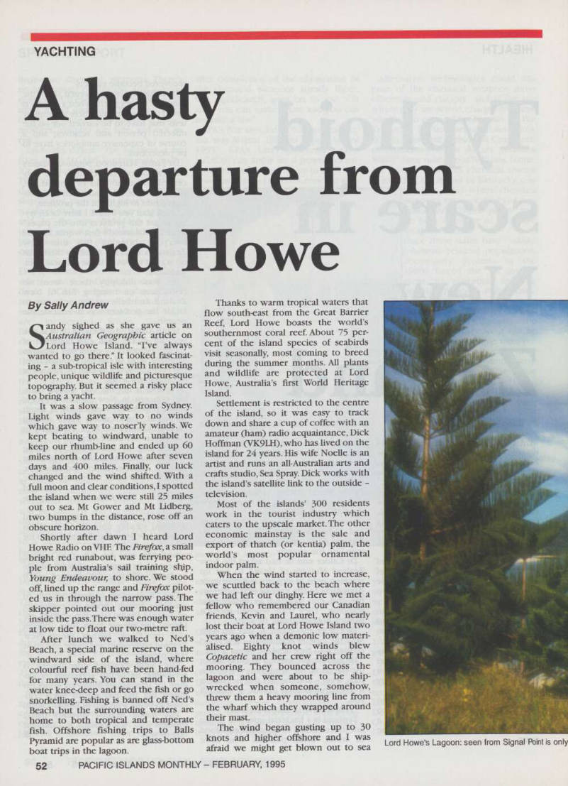
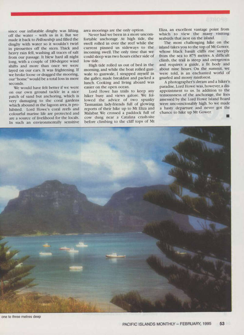
Lord Howe’s Lagoon: seen from Signal Point is only
since our inflatable dinghy was lifting off the water - with us in it. But we made it back to Fellowship and filled the dinghy with water so it wouldn’t twirl in pirouettes off the stern. Thick and heavy rain fell, washing all traces of salt from our passage. It blew hard all night long with a couple of 180-degree wind shifts and more than once we were layed on our ears. It was frightening. If we broke loose or dragged the mooring, our “home” would be a total loss in mere seconds.
We would have felt better if we were on our own ground tackle in a nice patch of sand but anchoring, which is very damaging to the coral gardens which abound in the lagoon area, is prohibited. Lord Howe’s coral reefs and colourful marine life are protected and are a source of livelihood for the locals, In such an environmentally sensitive
area moorings are the only option.
Never had we been in a more uncomfortable anchorage. At high tide, the swell rolled in over the reef while the current pinned us sideways to the incoming swell. The only time that we could sleep was two hours either side of low tide.
High tide rolled us out of bed in the morning, and while the boat rolled gunwale to gunwale, I strapped myself in the galley, made breakfast and packed a lunch. Cooking and living aboard was easier on the open ocean.
Lord Howe has trails to keep any hiker busy and views galore. We followed the advice of two spunky Tasmanian lady-friends full of glowing reports of their hike up to Mt Eliza and Malabar. We crossed a paddock full of cow dung near a Catalina crash-site before climbing to the cliff tops of Mt
Eliza, an excellent vantage point from which to view the many visiting seabirds that nest on the island, The most challenging hike on the island takes you to the top of Mt Gower, whose black basalt cliffs rise steeply from the sea to 875 metres. A difficult climb, the trail is steep and overgrown and requires a guide, a fit body and about nine hours. On the summit, we were told, is an enchanted world of gnarled and mossy rainforest, A photographer’s dream and a hiker’s paradise, Lord Howe was, however, a dis appointment to us. In addition to the tenuousness of the anchorage, the fees assessed by the Lord Howe Island Board were unconscionably high. So we made a hasty departure and never got the chance to hike up Mt Gower,
one to three metres deep