What Future For Rabaul?
pp. 32-34 · Read in the full issue
Papua New Guinea
The threat of eruption makes abandonment a possibility.
By Dr Russell Blong
EARTHQUAKES have always oc curred in the Rabaul area of New Britain. Indeed, though only a few of these are felt by the town’s inhabitants, 30 to 50 earthquakes a month were re corded at the Rabaul Volcanological Ob servatory (RVO) during the 19705.
In 1983-85, however, Rabaul was struck by a “seismic crisis”, with the number of earthquakes recorded reaching several thousand a month: more than 94,000 were recorded at RVO during the 14-month cri sis, and in late April 1984, as many as 350 quakes were recorded each day. Instru ments maintained by the Observatory in dicated that the southern end of Matupit Island rose by more than 0.6 metres dur ing the same period.
All these vital signs monitors of Ra baul’s volcanic health indicated that an eruption was both likely and imminent: placing at risk the third largest town in Papua New Guinea, the administrative capital of East New Britain Province, ex cellent port facilities and the centre of the rich agricultural hinterland of the Gazelle Peninsula. Rabaul town has a population of about 16,000, with more than 100,000 people in the immediate area potentially
at serious risk from a large eruption.
Rabaul town is built within the caldera of the volcano that is, within the area where volcanic vents occur and within the boundaries marked by the steep rim of the area that collapsed as a result of very large 6th century AD and earlier eruptions. The magnificent harbour, the very reason for Rabaul’s existence and its dominance of the Islands region of Papua New Guinea, is the product of volcanic eruptions. The caldera was created by large-scale erup tions and improved by smaller blasts that built volcanic cones to shelter Simpson Harbour from the southeast trades. The rich soils that produce Rabaul’s copra and cocoa the mainstays of the local econ omy and that support the subsistence economy of the 100,000-plus people of the Gazelle Peninsula, are also the product of numerous eruptions.
A Rabaul Disaster Plan was completed in June 1983 by a consultant expert from the office of the United Nations Disaster Relief Co-ordinator, before the onset of the August 1983 seismic crisis and before the passage of the 1984 Disaster Manage ment Act made it mandatory for such emergency plans to be prepared, and
four “alert” stages were recognised.
In Stage 1 there is a risk but no im mediate cause for alarm. At Stage 2, the risk has increased and a hazard situation is possible. Stage 3 is announced when the risk is serious and a hazard situation is probable. At Stage 4 the situation is criti cal, and a hazard situation is imminent or has already occurred.
A Stage 2 alert was declared in Rabaul on October 29, 1983. The local disaster committee, under the Chairmanship of Nelson Paulias, Secretary to the ENBP Government, formulated and completed plans to aid the evacuation of Rabaul should the situation escalate to Stage 3 and 4. Egress roads were widened, sealed and cleared of overhanging branches that might be toppled by quakes or fall under the weight of volcanic ash. A new wharf was built at Kabakaul, east of Kokopo, and a new airstrip was constructed at Tokua.
Water supplies were improved at evacua tion centres. The total cost of preparations was of the order of K 6 million.
One of the side-effects of the continu ing seismic crisis and uncertainties about the effects of an eruption on the town itself was the “insurance crisis”. Most busi nesses held “volcano insurance”, which provided cover against seismic (earth quake), volcano, and tsunami (erro neously called tidal wave) damage as an addendum to normal policies. As the cri sis deepened, however, under pressure from re-insurance companies overseas the insurance industry dramatically in creased rates for volcano cover and in some cases failed to renew this form of cover.
The highest rates applied to an area within 10 kilometres of Matupit Island. A second zone, from 10 to 20 kilometres, included Kokopo and Kerevat and a third zone ap plied to the rest of East New Britain.
At the same time, banks insisted the mortgagees in Rabaul hold volcano cover; this in turn led to an investment crisis and a loss of confidence in Rabaul and its fu ture. The seismic crisis was over by 1986, but development stagnated despite buoy ant agricultural commodity prices.
A spokesperson for one insurance company wrote: “The development of an alternative township and port with signif icant reduction to loss from natural geo physical perils is in our view essential, and would certainly be recognised by lower in surance rates”. For many, the obvious al ternative to Rabaul was Kokopo.
But this was not the first time the aban donment or relocation of Rabaul (capital
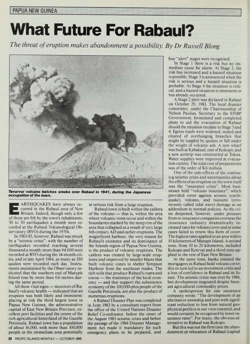
Tavurvur volcano belches smoke over Rabaul In 1941, during the Japanese occupation of the town.
of the Territory of New Guinea from 1914 to 1941) had been considered. The vol canic nature of Rabaul became evident to all on May 29, 1937 when the eruption of Vulcan began on the western side of the harbour on Saturday afternoon: Tavur vur, on the eastern side, erupted later.
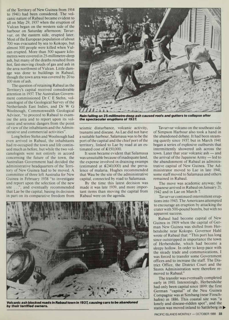
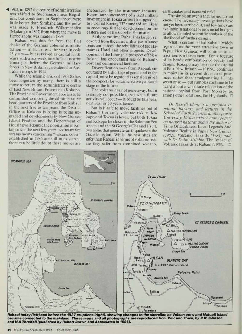
Most of the European population of about 700 was evacuated by sea to Kokopo, but almost 500 people were killed when Vul can erupted. More than 500 square kilo metres were covered in 25-millimetre-deep ash, but many of the deaths resulted from hot, fast-moving clouds of gas and ash in the area northwest of Vulcan. Little dam age was done to buildings in Rabaul, though the town area was covered by 20 to 100 mm of ash.
The question of retaining Rabaul as the Territory’s capital received considerable attention in 1937. The Australian Govern ment commissioned Dr C E Stehn, vol canologist of the Geological Survey of the Netherlands East Indies, and Dr W G Woolnough, Commonwealth Geological Advisor, “to proceed to Rabaul to exam ine the area and to report upon its vol canic and seismic dangers from the point of view of the inhabitants and the Admin istrative and commercial activities”.
Long before Stehn and Woolnough had even arrived in Rabaul, the inhabitants had re-occupied the town and life contin ued much as before, but while the two vol canologists were not entirely in accord concerning the future of the town, the Australian Government had decided the administrative headquarters of the Terri tory of New Guinea had to be moved. A committee of three left Australia for New Guinea in February 1938 “to investigate and report upon the selection of the new site .. ”, and eventually recommended that Lae be the capital, basing its decision in part on its comparative freedom from
seismic disturbance, volcanic activity, tsunami and disease. As Lae did not have a suitable harbour, Salamaua was to be the port of the capital and the chief port of the territory, linked to Lae by road at an es timated cost of £150,000.
It soon became evident that Salamaua was unsuitable because of inadequate land, the expense involved in draining swamps (estimated at £240,000) and the preva lence of malaria. Hughes recommended that Wau be the site of the administrative capital, connected by road to Salamaua.
By the time this latest decision was made it was late 1939, and more impor tant items than moving the capital from Rabaul were on the agenda.
Tavurvur volcano on the southeast side of Simpson Harbour also took a hand in the abandoned debate. It had been steam ing quietly since 1937, but in March 1941 began a series of explosive outbursts that intermittently showered ash across the town. Later that year volcanic ash and the arrival of the Japanese Army led to the abandonment of Rabaul as adminis trative capital of New Guinea. The Ad ministrator moved to Lae in late 1941, some staff moved to Salamaua and others remained in Rabaul.
The move was academic anyway; the Japanese arrived in Rabaul on January 21, 1942 and in Lae on March 7.
Tavurvur continued intermittent erup tions into 1943. The Americans attempted to encourage an eruption by attacking the crater with 500-pound bombs, but with no apparent success.
Rabaul had become capital of New Guinea in 1909 when the capital of Ger man New Guinea was shifted from Her betshdhe near Kokopo. Governor Hahl wrote of Rabaul that: “This port has long since outstripped in importance the town of Herbetshohe, which had become a sleepy hollow. In order to keep pace with the steady trade and communications, I was forced to transfer some Government offices and to increase the staff. The Dis trict Office, the District Court and the Stores Administration were therefore re moved to Rabaul.”
The transfer was eventually completed early in 1910. Interestingly, Herbetshohe had only been capital since 1899: the first German “capital” of the Neu Guinea Compagnie was at Simbang (near Finsch hafen) in 1886. This coastal site was “a lonely and disease-ridden spot”, and the station was moved inland to Sattleberg in
Volcanic ash blocked roads In Rabaul town in 1937, causing cars to be abandoned by their terrified owners.
Rain falling on 25-millimetre-deep ash caused roofs and gutters to collapse after the spectacular eruptions of 1937.
◄ 198 ° ; m 1892thecentreofadmmistration was shifted to Stephansort near Bogadijm, but conditions in Stephansort were little better than Simbang and the move was made to Friedrich Wilhemshafen (Madang) in 1897, from where the move to Herbetshohe was made in 1899.
Rabaul was thus far from the first choice of the German colonial admimstration in fact, it was the sixth m only 25 years but survived as capital for 31 years with a six-week interlude at nearby Toma just before the German military torces in New Britain surrendered to Austrahan troops in 1914.
While the seismic crisis of 1983-85 has been forgotten by many, there is still a move to return the administrative centre of East New Britain Province to Kokopo.
The Provincial Government appears to be committed to moving the administrative headquarters of the Province from Rabaul in the next five to ten years; the District Office at Kokopo is being is being upgraded and developments by New Guinea Island Produce and the Department of Housing will double the population of Kokopo over the next few years. As insurance arrangements concerning “volcano cover” established in 1986 are still in existence, there can be little doubt these moves are
encouraged by the insurance industry.
Recent announcements of a K2O million investment in Tokua airport to upgrade it to F2B and Boeing 737 standard are likely to encourage further development on the eastern end of the Gazelle Peninsula.
At the same time Rabaul has largely re covered from the crisis with a rise in house rents and prices, the rebuilding of the Ha mamas Hotel and other projects. Devel opment of the Lihir gold prospect off New Ireland has encouraged use of Rabaul’s port and commercial facilities.
Diversification away from Rabaul, en couraged by a shortage of good land in the capital, must be regarded as sensible given the prospects for volcanic activity at some stage in the future.
The volcano has not gone away, but it is simply not possible to say when future activity will occur it could be this year, next year or 50 years hence.
But is it safe to move facilities out of Rabaul? Certainly volcanic risk at Ko kopo and Tokua is lower, but both Tokua and Kokopo lie closer to the Solomon Sea trench and the St George’s Channel Fault, two areas that generate earthquakes in the Gazelle region. While the new sites are safer than Rabaul in terms of volcanic risk, are they safer from combined volcano,
earthquakes and tsunami risk?
The simple answer is that we just do not know. The necessary investigations have not yet been carried out, and few funds are available in national or provincial budgets to allow detailed scientific analysis of the likelihood of further danger.
What is certain is that Rabaul (widely regarded as the most attractive town in Papua New Guinea) will continue to at tract tourism investment, if only because of its heady combination of beauty and danger. Kokopo may become the capital of East New Britain if PNG continues to maintain its present division of prov inces rather than amalgamating 19 into seven or so but rumbles continue to be heard about a wholesale relocation of the national capital from Port Moresby to, among other locations, the Highlands. □ Dr Russell Blong is a specialist in natural hazards, and lectures in the School of Earth Sciences at Macquarie University. He has written many papers on natural hazards and is the author of Time Of Darkness: Local Legends And Volcanic Reality in Papua New Guinea (1982), Volcanic Hazards (1984) and, with Dr Dolin Aislabie, The Impact of Volcanic Hazards at Rabaul (1988). □
Rabaul today (left) and before the 1937 eruptions (right), showing changes to the shoreline as Vulcan grew and Matupit Island became connected to the mainland. These maps and all photographs are reproduced from Volcano Town, by RW Johnson and N A Threlfall (published by Robert Brown and Associates in 1985).