Charting the course of Luis Vaez de Torres
pp. 47-48 · Read in the full issue

Luis Vaez de Torres
Brett Milder, master mariner, historian and artist, whose last book is reviewed on this page, died at his home at Currumbin in the Australian state of Queensland just as this issue of RIM was going to press. He was 70 years of age. Captain Milder, who was a former commodore of the Burns Philp Shipping Line, a wing commander with the Royal Australian Air Force and founder of the Australian Institute of Navigation, was widely known throughout the Pacific for his research into early Polynesian and early European voyaging. The story of his achievements will be published in the June issue of PIM.
The Voyage of Torres. By Brett Milder. Published by Univer sity of Queensland Press, PO Box 42, St Lucia, Australia, 4067. $ A 11.9 5 Cloth. ISBN 0 7022 1275 X.
In 1606 when Luis Vaez de Torres passed through the treacherous waters that separ ate New Guinea from the northern tip of Australia, where, precisely, did he go?
Curiosity in the case of PI M’s old friend Captain Brett Milder eventually persuaded him that the subject was worthy of de tailed study, and he enrolled at Macquarie University, Sydney, to write a master’s thesis in which Torres’ voyage through Torres Strait was the pivotal theme. Having been awarded a master’s degree for the thesis in 1976, he has now turned the thesis into an attractive book.
In the introduction, Milder explains that he first saw Torres Strait in 1928 when he began his seagoing career as a cadet on ships trading between Aust ralian ports and the East Indies.
In more recent times, he has frequently been in the strait as a skipper of ships trading be tween Sydney and the Gulf of Carpentaria, and on tankers taking oil to the gulf from Port Moresby. Moreover, Milder has also ‘tramped the shores’ of Big Bay, Espiritu Santo, Vanuatu, where Torres was one of the expedition led by Pedro Fernandez de Quiros when he planned to build the city of New Jerusalem at that place.
After the New Jerusalem plan failed, Quiros, in the expedition's flagship, became separated from Torres and the other two ships, and sailed back to America. Torres decided to head for Manila by taking a westerly route.
For many years, little was known about Torres’ precise course because the only docu ments about it that had come to light were a couple of brief accounts one written by Torres himself and one based on a letter from him. Then a document turned up in London that filled in many missing details. Ii was a narrative of the voyage by one of Torres’ com panions, Don Diego dc Prado y Tovar, an aristocratic adven turer. In addition, it turned out that four charts by Prado had survived, depicting Big Bay and several key parts of New Guinea.
Wiih the publication of an English translation of Prado's narrative in 1930. most scholars concluded that Torres had sailed between New Guinea and Australia in about 10 degrees South. But a couple opined that the passage he used was the one that Cook found in 1770 and called Endeavour Strait. And
against these conclusions were the views of several earlier scholars that Torres had hugged the coast of New Guinea.
Even in these days when buoys, beacons, detailed charts and weather reports make the task of threading through the reefs and shoals relatively easy, there is still a band of specially trained Torres Strait pilots.
Therefore any ship’s captain who has had much to do with the Torres Strait area is bound to become curious about how Torres himself, with a 100-ton galleon and a rather smaller launch, managed to get through with no navigational aids at all.
Milder set out to seek the correct answer by plotting Torres' course along the entire New Guinea coast. This in volved checking all known facts about the voyage against his own knowledge of New Guinean waters, winds, tides, 17th-century navigational tech niques, practical seamanship, etc. His conclusion is that Endeavour Strait was the pass-
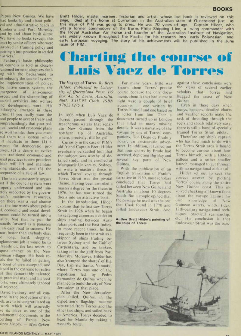
Author Brett Hilder's painting of the ships of Torres.
age that Torres used, and that in doing so he was in sight of the Cape Yorke Peninsula for two days.
In reaching his conclusion, Hilder found that two import ant lines had been omitted from a transcript of a letter from Torres to the Spanish king, and that this omission had led earlier scholars astray.
Hilder’s book is a work of painstaking detection with no fewer than 71 illustrations, of
which seven are in colour. The latter include three of Prado’s charts.
Anyone who cares to follow Hilder in Torres’ wake is un likely to disagree with him on major issues. Also, it is difficult to resist his finding that, as an exercise in 17th-century dis covery, navigation, surveying, seamanship, endurance and sur vival on native foods, Torres’ voyage was one of great merit.
Robert Langdon.