Lewis, The Navigator, Sails
pp. 48-49 · Read in the full issue
Books
With Famous Predecessors
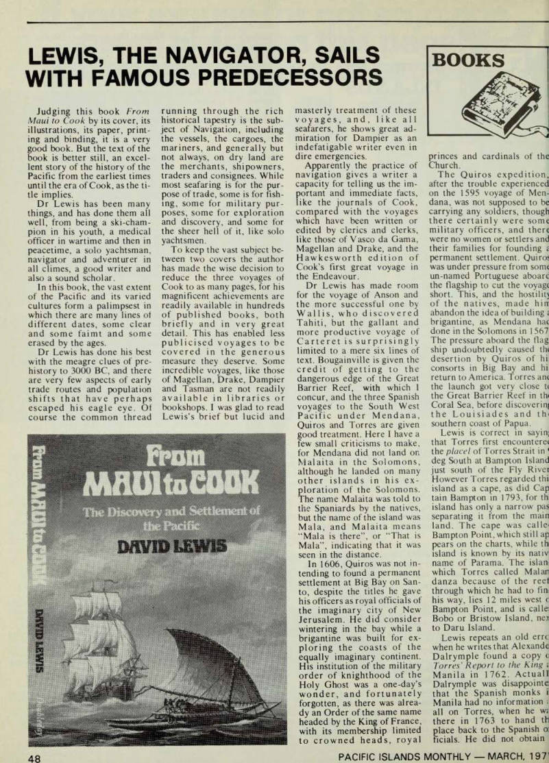
Judging this book From Maui to Cook by its cover, its illustrations, its paper, print ing and binding, it is a very good book. But the text of the book is better still, an excel lent story of the history of the Pacific from the earliest times until the era of Cook, as the ti tle implies.
Dr Lewis has been many things, and has done them all well, from being a ski-cham pion in his youth, a medical officer in wartime and then in peacetime, a solo yachtsman, navigator and adventurer in all climes, a good writer and also a sound scholar.
In this book, the vast extent of the Pacific and its varied cultures form a palimpsest in which there are many lines ol different dates, some clear and some faimt and some erased by the ages.
Dr Lewis has done his best with the meagre clues of pre history to 3000 BC, and there are very few aspects of early trade routes and population shifts that have perhaps escaped his eagle eye. Of course the common thread
running through the rich historical tapestry is the sub ject of Navigation, including the vessels, the cargoes, the mariners, and generally but not always, on dry land are the merchants, shipowners, traders and consignees. While most seafaring is for the pur pose of trade, some is for fish ing, some for military pur poses, some for exploration and discovery, and some for the sheer hell of it, like solo yachtsmen.
To keep the vast subject be tween two covers the author has made the wise decision to reduce the three voyages of Cook to as many pages, for his magnificent achievements are readily available in hundreds of published books, both briefly and in very great detail. This has enabled less publicised voyages to be covered in the generous measure they deserve. Some incredible voyages, like those of Magellan, Drake, Dampier and Tasman are not readily available in libraries or bookshops. I was glad to read Lewis’s brief but lucid and
masterly treatment of these voyages, and, like all seafarers, he shows great ad miration for Dampier as an indefatigable writer even in dire emergencies.
Apparently the practice of navigation gives a writer a capacity for telling us the im portant and immediate facts, like the journals of Cook, compared with the voyages which have been written or edited by clerics and clerks, like those of Vasco da Gama, Magellan and Drake, and the Hawkesworth edition of Cook’s first great voyage in the Endeavour.
Dr Lewis has made room for the voyage of Anson and the more successful one by Wallis, who discovered Tahiti, but the gallant and more productive voyage of Carteret is surprisingly limited to a mere six lines of text. Bougainville is given the credit of getting to the dangerous edge of the Great Barrier Reef, with which 1 concur, and the three Spanish voyaged to the South West Pacific under Mendana, Quiros and Torres are given good treatment. Here I have a few small criticisms to make, for Mendana did not land on Malaita in the Solomons, although he landed on many other islands in his ex ploration of the Solomons.
The name Malaita was told to the Spaniards by the natives, but the name of the island was Mala, and Malaita means “Mala is there”, or “That is Mala”, indicating that it was seen in the distance.
In 1606, Quiros was not in tending to found a permanent settlement at Big Bay on San to, despite the titles he gave his officers as royal officials of the imaginary city of New Jerusalem. He did consider wintering in the bay while a brigantine was built for ex ploring the coasts of the equally imaginary continent.
His institution of the military order of knighthood of the Holy Ghost was a one-day’s wonder, and fortunately forgotten, as there was alrea dy an Order of the same name headed by the King of France, with its membership limited to crowned heads, royal
princes and cardinals of the Church.
The Quiros expedition,, after the trouble experienced on the 1595 voyage of Men dana, was not supposed to be carrying any soldiers, though there certainly were some military officers, and there were no women or settlers and their families for founding £ permanent settlement. Quiros was under pressure from some un-named Portuguese aboarc the flagship to cut the voyage short. This, and the hostility of the natives,, made hin abandon the idea of building i brigantine, as Mendana hac done in the Solomons in 1567 The pressure aboard the flag ship undoubtedly caused the desertion by Quiros of hi; consorts in Big Bay and hi return to America. Torres anc the launch got very close t( the Great Barrier Reef in th» Coral Sea, before discovering the Louisiades and thi southern coast of Papua.
Lewis is correct in sayin] that Torres first encountere* the place I of Torres Strait in ' deg South at Bampton Island just south of the Fly Rivet However Torres regarded thii island as a cape, as did Cap tain Bampton in 1793, for thi island has only a narrow pas separating it from the main land. The cape was calle< Bampton Point, which still ap pears on the charts, while th island is known by its nativ name of Parama. The islan. which Torres called Malan danza because of the reel through which he had to fim his way, lies 12 miles west c Bampton Point, and is calle: Bobo or Bristow Island, nex to Daru Island.
Lewis repeats an old errc when he writes that Alexande Dalrymple found a copy o Torres’ Report to the King ; Manila in 1762. ActualK Dalrymple was disappointed that the Spanish monks i: Manila had no information : all on Torres, when he w* there in 1763 to hand tb place back to the Spanish a ficials. He did not obtain
:opy ot the Report until about 1780, 10 years after Cook had •ediscovered the Strait.
Dalrymple was sent a copy Tom a historian friend in Jpain, and he translated it nto English and gave it to Captain Burney to include in lis volumes of Voyages. It irst appeared in print in 806, exactly 200 years after forres’ voyage, and Captain lurney, who should have
:nown better, carelessly wrote
hat the Report had been ound in Manila, and Flinders n 1814 was the first to repeat he error; I don’t suppose that -ewis will be the last.
The point of this question is hat if Dalrymple had the Re tort in 1763 he would have mb li shed it in his book on
'acific Voyages, whLn he
,ave to Banks for the voyage •f the Endeavour, along with chart of the various tracks, ncluding a dotted line of Tor es’ track from the meagre in ormation he had at the time, lanks discussed these with ■took, who had the idea that orres had sailed north of «ew Guinea, an error based n a French author, Pingre.
As a result of this, when Cook got through Torres Strait he only claimed the merit of hav ing cleared up a doubtful point, instead of claiming to have discovered the Strait, which was later named Torres Strait by Dalrymple.
On page 112 the date 1605 is wrongly given for the first discovery of part of the Australian mainland by the Dutch vessel Duyfken. To the best of our knowledge the Duyfken was off the western edge of Torres Strait in March and April, 1606. On page 112, the death of Quiros is dated 1614, whereas we know that he died at Panama after his ar rival there in June, 1615. We don’t know the exact date, but his widow received money owed to him by the govern ment in February, 1616.
Lewis mentions that when Quiros and Torres were at Taumako they saw large sea going canoes up to 18.5 m in length. An illustration is given of the outrigger type called Te Puke, probably seen by Lewis on his visit to the island a few years ago. He seems to have overlooked the report of 18.4
m canoes written by Prado in 1606, in which he describes in great detail the twin hulls, 5.5 m in circumference, carrying a deckhouse with a fighting platform on its roof. This re port was very badly translated m 1929, but the canoe carried more sail than the launch in the Spanish squadron. On page one, Lewis has a drawing of a twin-hulled canoe of Mailu island in Papua, com monly called lakatoi and carrying a crab-claw sail simi lar to that shown on Te Puke on page 110.
The sketches throughout the book are most artistically drawn, and delicately printed in green ink. A few of the smaller ones in the margins are a little too faint in parts, and I must object to the one of a marine sextant, which is drawn back to front, and the telescope is drawn too high up, so that it is not pointing to the horizon mirror.
That is on page 165, while on page 69 is a sketch of an astrolabe, but it is not a marine one, having com plicated circles on it for use ashore by astronomers or astrologers. These slight blemishes in the book are not the fault of the author, and they lead me to mention more important criticisms of the work of the editor or pub lishers.
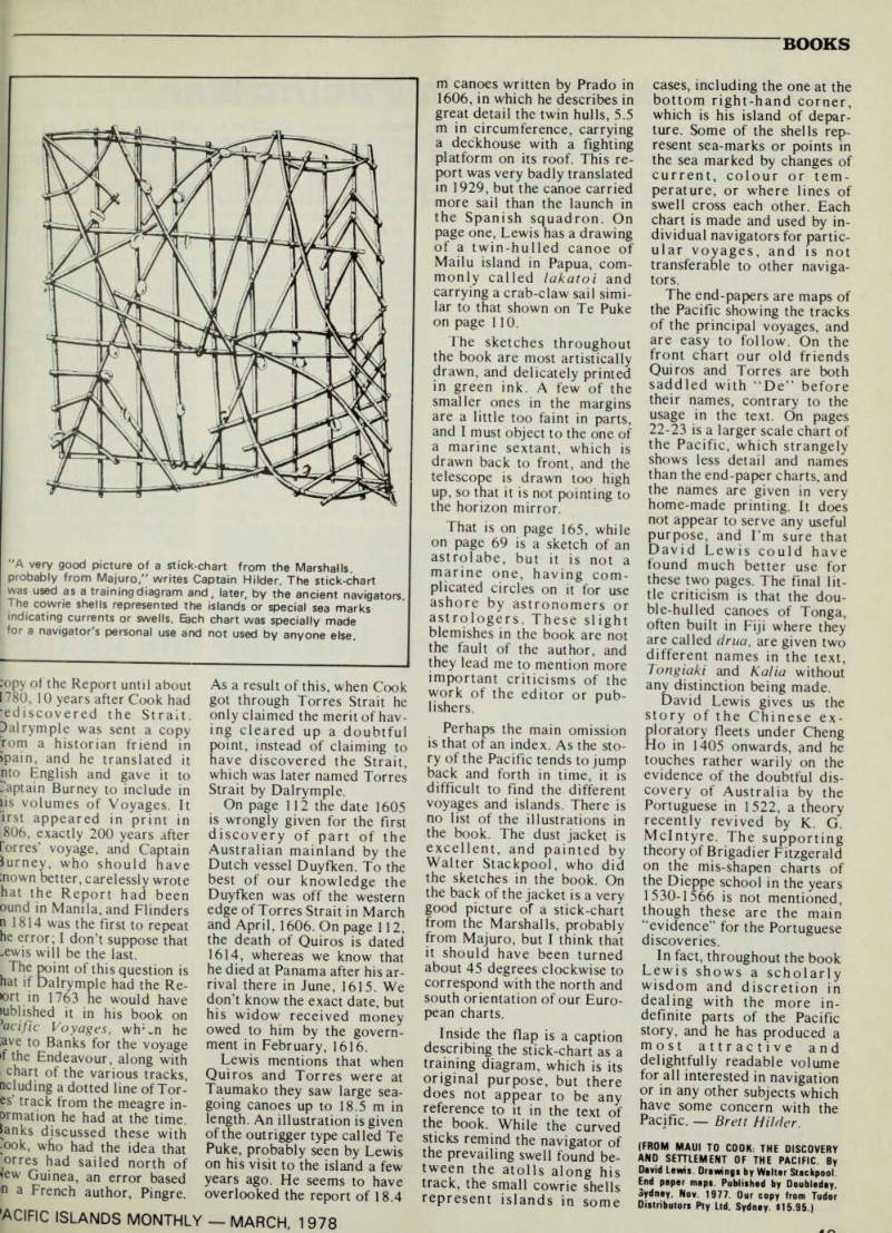
Perhaps the main omission is that of an index. As the sto ry of the Pacific tends to jump back and forth in time, it is difficult to find the different voyages and islands. There is no list of the illustrations in the book. The dust jacket is excellent, and painted by Walter Stackpool, who did the sketches in the book. On the back of the jacket is a very good picture of a stick-chart from the Marshalls, probably from Majuro, but I think that it should have been turned about 45 degrees clockwise to correspond with the north and south orientation of our Euro pean charts.
Inside the flap is a caption describing the stick-chart as a training diagram, which is its original purpose, but there does not appear to be any reference to it in the text of the book. While the curved sticks remind the navigator of the prevailing swell found be tween the atolls along his track, the small cowrie shells represent islands in some
cases, including the one at the bottom right-hand corner, which is his island of depar ture. Some of the shells rep resent sea-marks or points in the sea marked by changes of current, colour or tem perature, or where lines of swell cross each other. Each chart is made and used by in dividual navigators for partic ular voyages, and is not transferable to other naviga tors.
The end-papers are maps of the Pacific showing the tracks of the principal voyages, and are easy to follow. On the front chart our old friends Quiros and Torres are both saddled with “De” before their names, contrary to the usage in the text. On pages 22-23 is a larger scale chart of the Pacific, which strangely shows less detail and names than the end-paper charts, and the names are given in very home-made printing. It does not appear to serve any useful purpose, and I’m sure that David Lewis could have found much better use for these two pages. The final lit tle criticism is that the dou ble-hulled canoes of Tonga, often built in Fiji where they are called drua, are given two different names in the text, Tongiaki and Kalia without any distinction being made.
David Lewis gives us the story of the Chinese ex ploratory fleets under Cheng Ho in 1405 onwards, and he touches rather warily on the evidence of the doubtful dis covery of Australia by the Portuguese in 1522, a theory recently revived by K. G.
Mclntyre. The supporting theory of Brigadier Fitzgerald on the mis-shapen charts of the Dieppe school in the years 1530-1566 is not mentioned, though these are the main “evidence” for the Portuguese discoveries.
In fact, throughout the book Lewis shows a scholarly wisdom and discretion in dealing with the more in definite parts of the Pacific story, and he has produced a most attractive and delightfully readable volume for all interested in navigation or in any other subjects which have some concern with the Pacific. Brett Milder.
(From Maui To Cook: The Discovery
And Settlement Of The Pacific. By
David Lewis. Drawings by Walter Stackpool End paper maps. Published by Doubleday, Sydney, Nov. 1977. Our copy from Tudor Distributors Pty Ltd, Sydney. $15.95.)
"A very good picture of a stick-chart from the Marshalls, probably from Majuro,” writes Captain Milder. The stick-chart was used as a training diagram and, later, by the ancient navigators The cowrie shells represented the islands or special sea marks indicating currents or swells. Each chart was specially made for a navigator's personal use and not used by anyone else.