Magazine Section
pp. 89-91 · Read in the full issue

The Challenge Of New
Guinea's Virgin Alps
By James Porter
When I climbed Mt. Wilhelm two years ago, its altitude was shown on all the maps as 15,400 ft. It was rather deflating to the ego therefore to discover on the latest survey charts that it is a mere 14,793 ft above sea-level. But even at this height it remains the territory’s highest, although there are some contenders across the border in West Irian.
Wilhelm’s jagged peak forms part of the Bismarck Ranges in the area just north of Goroka and Mount Hagen. First recorded sighting of the mountain was by members of a German expedition to the nearby Finisterre Ranges in 1888, led by German scientist and explorer Hugo Zoller.
They named the four highest peaks of the Bismarck Range after the children of Bismarck from north to south, they are Herbert Berg, Marien Berg, Wilhelm Berg and Otto Berg.
Although these ranges are only six degrees south of the equator, snow falls often form temporary belts on the mountainsides in some areas. For most of the year though, snow is limited by the presence of warm winds coming up from lower altitudes, melting it quickly into isolated hard ice-packs in the gullies.
Some snow
But whether or not one actually sees snow, the change in climate from the hot humid coastal strip to the chill high altitude air of New Guinea’s Alps is quite startling.
Most visitors or even residents of the territory miss out altogether on this unique area —alpine scenery on a tropical Pacific island. The tortuous mountain backbone of New Guinea has a deservedly rugged reputation, yet access to some of these areas is a good deal easier than many people would expect.
For the person who is reasonably fit and used to walking, a visit to at least the foothills of these mountains
is well within the realm of possibility.
An experienced bush-walker with overnight camping gear would have no trouble at all in ascending Mt.
Wilhelm itself in the space of a few days. No special mountaineering
equipment (such as ropes) is re quired.
Unlike many other high peaks, requiring days, sometimes weeks of approach on foot, Wilhelm is fortu nately within reasonable walking distance of Keglsugl Mission airstrip at 8,000 ft altitude, a mere half-hour’s flight by light aircraft from Goroka.
One day’s walk from Keglsugl village at the end of the strip are the beautiful high altitude Pinde-Aunde Lakes and waterfalls at 11,500 ft.
With a base camp here, Mt. Wilhelm summit may be climbed (up and back) in a day if one commences bright and early.
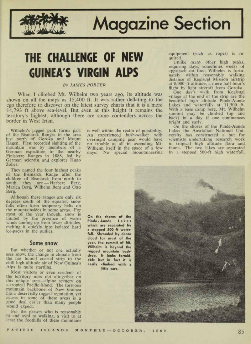
On the shores of the Pinde-Aunde Lakes the Ausrtalian National Uni versity has constructed a hut for scientists undertaking research work in tropical high altitude flora and fauna. The two lakes are separated by a stepped 500-ft high waterfall.
On the shores of the Pinde-Aunde Lakes which are separated by a stepped 500 ft water fall. Shrouded by dense cloud for most of the year, the summit of Mt.
Wilhelm is beyond the rugged mountain back drop. It looks formid able but in fact it is easily climbed with a little care.
Wilhelm dominates
Lake Pinde being the higher of the two.
Beyond the half-mile-wide lakes, a rugged mountain backdrop soars sky ward in real alpine grandeur to the dominating peak of Wilhelm. The summit itself is out of sight behind this first guardian.
With its lakes, snow, grass and steep rock faces, this area reminded me strikingly of the Cradle Mountain and Dove Lake region in the Cradle Mountain-Lake St. Clair National Park reserve of Tasmania, a favourite resort for Australian bush-walkers.
But Wilhelm is more than twice the height of Australia’s tallest alp, Mt. Kosciusko, and one is certainly well aware of the exhausting effects of high altitude air at this level, ap proaching 15,000 ft.
A few people are unable to adjust readily to the change in oxygen con tent of the air which affects blood cells even in the region of 10,000 ft.
For them “high altitude sickness” will spoil the pleasure, but a normally active person acclimatises very quickly indeed.
Short breath
During our own climb we ex perienced the “short breath” effect and one or two had slight migraine headaches, but only one member was unable to reach the top. He remained in camp at the lakes at 11,000 ft.
The best approach for anyone attempting the top is to base at the Pinde-Aunde Lakes. A Chimbu native guide can be hired for a nominal sum from Keglsugl village if one is unsure of the route.
From Keglsugl the route passes along a stony creek bed for a mile before climbing steeply through dense moss forest to the lower end of a terminal moraine at 10,000 ft. The view from this moraine of the wide Chimbu Valley and the airstrip 2,000 ft below, is in itself spectacular enough to warrant the climb thus far.
Approaching the upper end of the moraine after an early walk along its bed of another mile, a waterfall can be seen which is actually just below Lake Aunde, situated on a small plateau above the timber line.
Following an overnight camp at the lakes, either in one’s own tent or using one of the three or four empty native huts in the area, the keen climber will rise before daylight for the main ascent. It is a fairly steep scramble up above the western side of the lakes, passing right by the
Fabulous view
remains of an aircraft (World War II American bomber) on the ridge be low Wilhelm at about 13,000 ft.
Unless you are already altitude acclimatised by a few days at base camp, rest periods will become more frequent above this level, which is all grass, devoid of timber. Skirting around the base of Wilhelm and over a saddle at approximately 14,000 ft, the summit cairn can be seen about half-a-mile off on a great pile of jagged rocks forming the top.
Apart from a short climb over an exposed face 50 ft below the top, which requires some care (there is a straight drop of several hundred feet below this on the eastern side), no real climbing skill is required.
You will need some luck with the weather, of course, to see the fabulous view of the coastline at Madang and Astrolabe Bay 60 miles away, as these peaks are more often than not shrouded in cloud. The day we arrived at the summit cairn at midday, we saw only other mountain peaks sticking up out of a broad layer of white cloud beneath our feet.
Unconquered
But a few weeks before that I had observed what must be almost the same view of Madang from the top of Mount Otto (11,634 ft high in the same range) on a perfect, cloudless day. That mountain is also within easy reach of Goroka.
For the more energetic climber there are plenty of other challenges well within the scope of a bush walking party, i.e., they don’t require a major expedition.
One of these is Mount Herbert (14,000 ft) about eight miles north west of Wilhelm which is apparently yet unclimbed. Perhaps attempts had been made by patrol officers ap proaching it from Kundiawa, who found difficulty in locating the peak from ground level amid the jumble of valleys and lower mountains which form the approaches on all sides.
Herbert Berg had thus earned the reputation of being New Guinea’s most elusive mountain. But even when this is conquered, the list of unclimbed cloud - scrapers lurking along the unexplored ribs of the high backbone of New Guinea is as yet unlimited.
Epeli Vale Sekidrau, of the Yasawa Islands, helps to make his corner of Fiji an entrancing place for the lucky tourists who get there.
It is a three-day trip from Lautoka in converted Fairmile cruisers, and pretty expensive, but how pleasant it is to be a millionaire, if only for three days!
On the first night we met Epeli, at his village of Nabukeru, in the north of the Yasawas. The occasion was an evening entertainment in a large meeting house, one end packed with a mass of Fijians, and the rest comfortably filled with flickering torches, cameras and millionaires.
The leader of the dance-band bowed humbly and doffed his flowered coronet to the audience, then turned to the massed performers, whispered a few words, and the show was on.
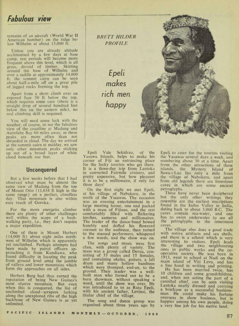
The songs and music were first class, with plenty of variety. The mass was a group called Derua, con sisting of 33 males and 15 females, and containing ukeles, guitars, a lali drum and many hollow bamboos which were thumped, end-on, to the ground. Their leader was a well built man who turned out to be a born showman, without speaking a word, until the show was over. He was introduced to us as Ratu Epeli, with his ancient father, Levinai, the titular chief of the village.
The song and dance group was organised about three years ago by
Epeli to cater for the tourists visiting the Yasawas several days a week, and numbering about 30 at a time. Apart from the other attractions of these islands, the Mystery Island of Sawa-i-Lau lies only a mile from the village of Nabukeru, and apart from old legends there are limestone caves in which are some ancient petroglyphs.
These have never been deciphered but the only other writings they resemble are the earliest inscriptions found in the Indus Valley in India, dating back to about 3,000 B.C. The caves contain sea-water, and one has to swim underwater to see all the petroglyphs in the innermost caves.
The village also does a good trade with native artifacts and sea shells, and there is a school which is very interesting to visitors. Epeli leads the village and two neighbouring ones in public works and the co operative society. He was born in 1913, went to school at Nadi on the main island of Viti Levu, and has, a fine hand in writing and printing.
He has been married twice, has 10 children and some grandchildren, and, when not acting the part of a cannibal chief, can be seen visiting Lautoka neatly dressed and carrying a briefcase as a successful business man. He could make his fortune overseas in show business, but is happier among his own people, doing a very fine job for his native land.
Brett Hilder
Profile
Epeli makes rich men happy