Book Reviews
pp. 95-96 · Read in the full issue
How the Admiralty chart came into being
If Captain Cook had not been killed in Hawaii in 1778, King George 111, who had taken a keen interest in the explora tion of the Pacific, would probably have appointed him the Admiralty’s first Hydrographer.
S it was, it was not until 1795 - that the post was created —the n who got the job being Cook’s erest critic, Alexander Dalrymple, 0 had been hydrographer to the st India Company since 1779.
With a budget of £650 a year, ; of which he had to pay his own ary of £5OO a year and those of ) assistants, Dalrymple’s task was prepare charts from the huge ss of survey material that had emulated at the Admiralty over ny years, and to make it available the commanders of His Majesty’s ps. deviously, British naval com nders had had to content themselves h whatever charts they could buy m the private chart sellers of tidon.
Long line
fhe material that Dalrymple had work with came from four main irces: Charts that he and other mbers of the East India Company 1 compiled from surveys in the ddle and Far East during the vious 20 years; privately published irts from all parts of the world; veys and charts of the coasts of sat Britain that had been com ssioned by the Admiralty; and nerous surveys of North America ich had been made following the [ of Quebec. In addition, there re a few charts of the Pacific by h explorers as Byron, Wallis and rteret, and particularly Cook, rook had learned his hydrography North America. But it was in Pacific that he really developed and it was there that he passed his methods, dedication and high ndards of accuracy to such officers Bligh, Vancouver and Riou.
Bligh, Vancouver and Co., in turn.
passed on those same qualities to such people as Matthew Minders and Midshipman Peter Heywood, of the Bounty —and so the long line of painstaking naval surveyors came into being who have made the British Admiralty’s charts among the foremost of the world.
The story of the development of the Admiralty charts from Dalrymple’s time to the end of the 19th century has now been told in detail by a man eminently qualified to do it—Rear-Admiral G, S. Ritchie, the Royal Navy’s present Hydro grapher.
Admiral Ritchie’s method is to describe the careers of the various Hydrographers and the technical developments that occurred in their time, and to intersperse his chapters on these matters with others on the more notable surveys and surveyors.
Charts on sale
There were, one learns, only seven Hydrographers of the Navy between Dalrymple’s dismissal under a cloud in 1808 and the end of the century.
Several incumbents in the post had exceptionally long reigns. Rear- Admiral Sir Francis Beaufort (who gave his name to the scale for wind measurement) lasted from 1829 to 1855 and Rear-Admiral Sir William J. L. Wharton from 1884 to 1904.
Dalrymple’s successor, Captain Thomas Hurd (1808-1823) has the distinction of conceiving the present practice of placing Admiralty charts
on sale to the public so that anyone in the world could use them.
He frequently urged this idea on the Lords of the Admiralty, suggest ing that the sale of charts could make his department self-supporting, and not a drain on the public purse as it had been until then.
The scheme was finally accepted in 1821, and the first catalogue of charts, with the name of agents from whom they could be bought, was published in 1825.
Meanwhile, Hurd had organised the supply of charts to the various stations on which Royal Navy ships were employed; and so, for the first time, British naval officers were made independent of the commercial chart sellers.
Hurd was succeeded by Captain
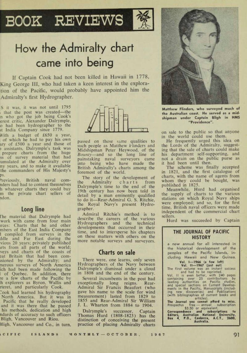
Matthew Flinders, who surveyed much of the Australian coast. He served as a mid shipman under Captain Bligh in HMS "Providence".
William Parry, who held office f< six years.
Parry spent more time explorir the Arctic than he did in workir in the Hydrographic Department; bi he was responsible for another gre; advance in the realm of hydrograpt —the compilation and publication < the Admiralty’s first sailing direction (Nowadays, the Admiralty’s series < sailing directions comprise more tha 70 volumes and cover the who world).
"High noon"
Parry’s successor, the long-reignir Rear-Admiral Beaufort, introduce further innovations during his ten in office, which Admiral Ritch describes as the “high noon” (
hydrography.
When he took office, there W£ no method whereby charts, one sold, could be kept correcte< Beaufort got round this difficulty b inaugurating first the Nautici Magazine and then Notices l Mariners in which new hydrographi information of importance t mariners was published. (Nowaday some 3,000 chart-correcting Notice to Mariners are published each year] By the time Beaufort left offic in 1855, the Royal Navy ha surveyors working in every oceai and, on the shelves, was a series c 2,000 charts covering every sea.
The Hydrographers who cam after Beaufort Washingtoi Richards, Evans and Wharton—mad further innovations and added furthe refinements to the work of thei office. But these were more in th nature of technical improvements i] surveying methods, than in th manner of making use of the results Admiral Ritchie’s book has a goo< deal to say about hydrographi surveying in the South Pacific. Bu the work of the officers of sue! ships as the Fly, Bramble, Rattle snake, Herald, Pandora (Captaii Byron Drury) and Salamander which worked in this region, realb deserve more ample treatment thai he is able to give them. In fact, j book entirely devoted to theii
activities would not be amiss.-
RL.
(The Admiralty Chart. Hollis Am
Carter, London. $9.80. Our copy Iron William Collins, Sydney.)