Forgotten French Navigator Blazed
pp. 83-87 · Read in the full issue
New Trails In The South Pacific
By Robert Langdon
About eight miles off the south coast of Papua, between Keppel Point and Cape Rodney, is a small, low, wooded island, which is marked on the charts as Coutance Island. About 450 miles east of this, at the extreme end of the Louisiade Archipelago, is another island of simi lar appearance called Adele.
T HE names of the two islands are A relics of a notable, yet completely forgotten voyage to the South Pacific in the first years of the 19th century, performed by an adventurous Frenchman, Captain Louis Ruault Coutance, in the 130-ton brig Adele.
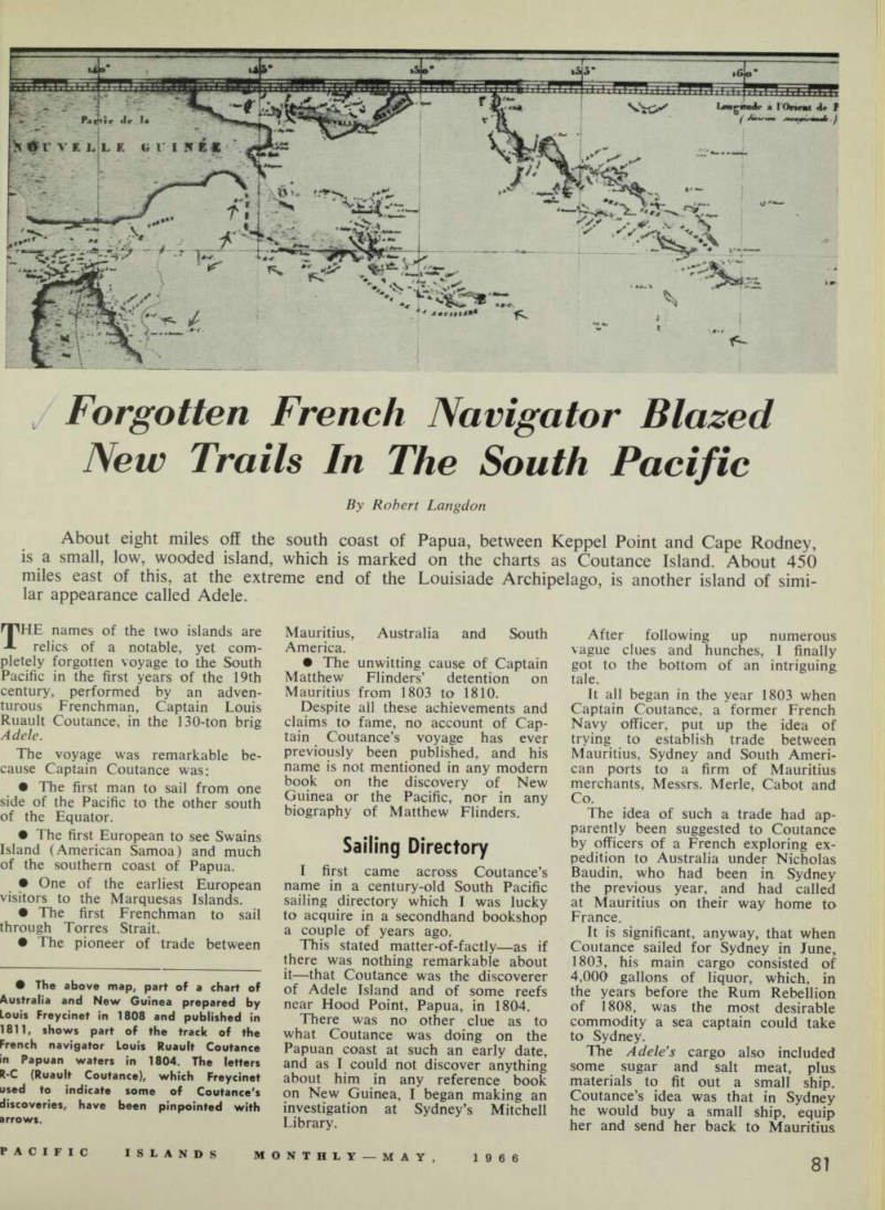
The voyage was remarkable because Captain Coutance was: • The first man to sail from one side of the Pacific to the other south of the Equator • The first European to see Swains Island (American Samoa) and much of the southern coast of pln.i ot tne southern coast of Papua. • One of the earliest European visitors to the Marquesas Islands. • The first Frenchman to sail through Torres Strait. • Ihe pioneer of trade between • , , a * i- 6 a j V L map A part ° f a chart of Australia and New Gmnea prepared by in'll* Fr * ycmet 18 ° 8 ® nd published m 1811, shows part of the track of the French navigator Louis Ruault Coutance I apuan waters m 1804. The letters K-c (Ruault Coutance), which Freydnet used to indicate some of Coutance's discoveries, have been pinpointed with arrows.
Mauritius, Australia and South America. • The unwitting cause of Captain Matthew Flinders’ detention on Mauritius from 1803 to 1810.
Despite ail these achievements and claims to fame, no account of Cap tain Coutance’s voyage has ever previously been published, and his name is not mentioned in any modern t? ook on th u e discovery of New guinea or the Pacific, nor in any biography of Matthew Flinders. c I- rv .
Sailing Directory
, 7 I fi rst came across Coutance’s name in a century-old South Pacific sailing directory which I was lucky to acquire in a secondhand bookshop a couple of years ago.
This stated matter-of-factly—as if there was nothing remarkable about it—that Coutance was the discoverer Ade i e Island and of some reefs near Hood Point, Papua, in 1804.
There was no other clue as to what Coutance was doing on the Papuan coast at such an early date, and as I could not discover anything about him in any reference book on New Guinea, I began making an investigation at Sydney’s Mitchell Library.
After following up numerous vague clues and hunches, I finally got to the bottom of an intriguing tale.
It all began in the year 1803 when Captain Coutance, a former French Navy officer, put up the idea of trying to establish trade between Mauritius, Sydney and South Ameri can ports to a firm of Mauritius merchants, Messrs. Merle, Cabot and Co The idea of such a trade had ap re"‘ly, bee " suggested to Coutance by officers of a French exploring ex pedition to Australia under Nicholas Baudin, who had been in Sydney the previous year, and had called at Mauritius on their way home to France.
It is significant, anyway, that when Coutance sailed for Sydney in June, 1803, his main cargo consisted of 4,000 gallons of liquor, which, in the years before the Rum Rebellion of 1808, was the most desirable commodity a sea captain could take to Sydney.
The Adele’s cargo also included some sugar and salt meat, plus materials to fit out a small ship, Coutance’s idea was that in Sydney he would buy a small ship, equip her and send her back to Mauritius
with a progress report before he went on to South America.
The Adele, with a crew of five officers, two pilots and 13 men, arrived in Sydney on July 15, 1803, after a voyage of six weeks. Britain and France were then enjoying a brief respite from their almost con stant wars; but there was still sus picion on both sides, and Coutance trod warily at first.
When Governor Philip Gidley King asked him why he had put into Sydney, Coutance said that he merely wanted to make repairs to the Adele's mast. Later, however, he told the truth and asked permission to sell his cargo.
Governor King gave his approval, even though he was then trying hard to put down the colony’s infamous trade in spirits, and it was official policy to discourage trade with foreigners.
Misunderstandings
The Governor reasoned that it was better to break the rules and make exceptions than to risk anta gonising a Frenchman, because, as he put it, “less causes have produced misunderstandings in politicks”.
However, King told Coutance that he and his countrymen could not expect to do any trade with New South Wales in the future; and he also gave him a letter to this effect to deliver to the Governor of Mauritius.
King then wrote another letter to Lord Hobart, the Colonial Sec retary in London, explaining what he had done. In this, he made no bones about the fact that in his view the less Sydney had to do with French-held Mauritius the better.
The letter turned out to be disastrous.
In it, King said: “I cannot help regarding the encouraging of com merce with the inhabitants of the Isle of France (Mauritius) but ill calculated for the prosperity of this colony, as spirits will be the general object of their commerce.
“Although there is no other in ducement for the French to cast their eyes on this country in case of a war but its recommendation for fertility, the spirit of conquest, ex tending their dominions, etc., yet I consider it my duty most respect fully submitting to your Lordship’s consideration the possibility in any future war of the Government of the Isle of France annoying this colony, as the voyage from thence may be done in less than seven weeks .. .”
Ships Wrecked
King’s letter, plus a copy of the one he had given to Coutance for the Governor of Mauritius, were dispatched to England in HMS Porpoise when that ship sailed from Sydney in company with HMS Cato and the merchant ship Bridgewater on August 10, 1803, A week later, however, the Porpoise and Cato went aground at Wreck Reef, 750 miles NNE of Sydney, and it was only through the resource of one of the Cato's pas sengers, Captain Matthew Flinders, that the crews of the two ships were saved.
Flinders, who had been going to England to seek a new ship to re place the condemned Investigator in which he had been surveying the Australian coast, sailed back to Sydney in a cutter with 13 other men to obtain help for the Wreck Reef castaways.
Governor King immediately gave him the colonial schooner Cumber land, and in this, he directed two other ships, Rolla and Francis , to the castaways’ aid.
After picking up the castaways, the Rolla sailed on to England via China; the Francis returned to Syd ney; and the Cumberland, with Flinders, proceeded to England via Torres Strait, having taken aboard, at Governor King’s request, the governor’s dispatches for England.
These dispatches, especially the plainspoken letter about trade with Mauritius, got Flinders into serious trouble when he put into Mauritius on December 16, 1803, to seek repairs to the Cumberland.
Britain and France, Flinders soon learned, were again at war, but, as he had a passport from the French Government he was not particularly concerned at this.
Yet when he went ashore to address himself to the Governor, Charles Decaen, he was told that he could not have sailed from Sydney in such a small ship as the Cumberland.
Therefore he could not be Flinders, but was an imposter and presumably a spy.
Flinders was confined aboard the Cumberland and all his books and papers were removed. Subsequently, he was interrogated by Decaen’s officers, who, it seems, decided that Decaen had misjudged him, and Decaen was persuaded to revise his opinion about Flinders.
To make amends, Decaen invited Flinders to dinner. Flinders haughtily refused. Decaen’s suspicions were again aroused, and Flinders was ordered to be confined on shore.
Governor Offended
It was after this that Governor King’s letter, warning Lord Hobart of the possible menace of the French in Mauritius in time of war, was discovered.
The letter gave great offence to Decaen, who thought Flinders was guilty of a grossly unfriendly act to be carrying such an anti-French document, when at the same time, he had a passport from the French Government, which gave him im munity in French ports even in time of war.
The result was that Flinders, who had no idea what was in any of King’s dispatches, was detained on Mauritius indefinitely—for seven years, as it turned out.
Meanwhile, Captain Coutance, the unwitting cause of Flinders’ deten tion, had spent 48 agreeable days in Sydney, which he thought was
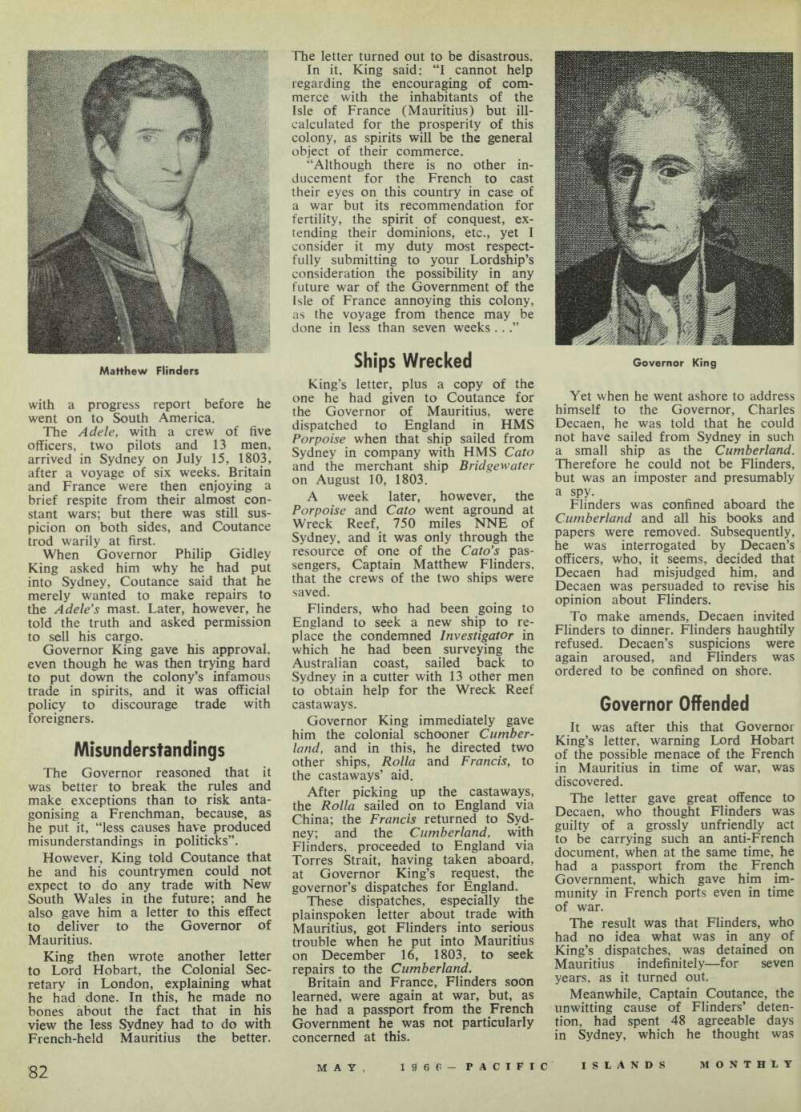
Matthew Flinders
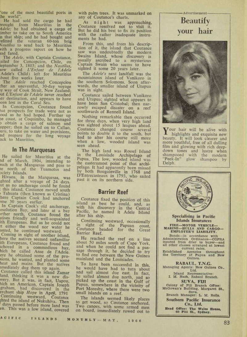
Governor King
‘one of the most beautiful ports in he world”.
He had sold the cargo he had jrought from Mauritius in the 4dele; he had obtained a cargo of imber to take on to South America n that ship; and he had bought and efitted the veteran 60-ton brig Nautilus to send back to Mauritius vith a progress report on how he lad fared.
The Adele, with Captain Coutance, ailed for Concepcion, Chile, on Jeptember 3, 1803; and the Nautilus, low called UEnfant de I’Adele Adele’s Child) left for Mauritius ibout five weeks later.
The Adele reached Concepcion fter an uneventful, 30-day voyage iy way of Cook Strait, New Zealand; •ut UEnfant de VAdele never reached ier destination, and appears to have een lost in the Coral Sea.
In Concepcion, Coutance found hat prospects for trade were not as ood as he had hoped. Further up le coast, at Coquimbo, he managed d obtain a cargo of salmon and opper; then he sailed on to Callao, ’em, to take on water and provisions, nd prepare for the long voyage ack to Mauritius.
In The Marquesas
He sailed for Mauritius at the id of March, 1804, intending to )uch at the Marquesas and pass to le north of the Tuamotus and aciety Islands.
Hivaoa, in the Marquesas, was ghted after a voyage of 24 days, ut as no anchorage could be found ; this island, Coutance moved south • Tahuata (then known as Cristina) here Captain Cook had anchored >me 30 years earlier.
In Captain Cook’s old anchorage, esolution Bay, and later at a bay irther north, Coutance found the atives friendly and well-acquainted ith Europeans. But as he could not ;t either the wood nor water he anted, he continued westward.
Coming in sight of another island, here the natives seemed unfamiliar ith Europeans, Coutance found and ichored in a commodious bay, hich he called Anse de I’Adele. ere he obtained some of the pro tons, he wanted, and planted some neat and maize. But the natives imediately dug them up again.
Coutance called this island Zamar land, thinking it was a new dis ivery. But it was, in fact, Uapou, Inch an American, Captain Joseph graham, had discovered in the erchant ship Hope in April, 1791 Continuing westward, Coutance pted the island of Nukuhiva. Then days passed before more land was en. This was a low island, covered
with palm trees. It was unmarked on any of Coutance’s charts.
As night was approaching, Coutance resolved not to visit it.
But he did his best to fix its position with the rather inadequate instru ments he had.
From this, and from his descrip tion of it, the island that Coutance saw was undoubtedly the modern Swains Island, whose discovery is usually ascribed to a mysterious Captain Swain who seems to have sighted it some 20 years later.
The Adele’s next landfall was the mountainous island of Vanikoro in the southern Solomons. Soon after wards, the smaller island of Utupua was in sight, Coutance sailed between Vanikoro and Utupua; sighted what appears to have been San Cristobal; then nar rowly escaped disaster on a reef southwards of Rennell Island.
Nothing remarkable then occurred for three days, when very high land was sighted about 15 leagues ahead.
Coutance changed course several points to double it to the south, but had to alter his course still more when a low, wooded island was seen ahead.
The high land was Rossel Island in the Louisiade Archipelago of Papua. The low, wooded island was the easternmost point of that archi pelago. It had apparently been missed by both Bougainville in 1768 and D’Entrecasteaux in 1793, who sailed past it on its northern side.
Barrier Reef
Coutance fixed the position of this island as best he could, and, as with his discovery in the Central Pacific, he named it Adele Island after his ship.
Continuing westward, occasionally in sight of the Papuan coast, Coutance headed for the Great Barrier Reef.
He reached the reef on a line about 50 miles south of Cape York, and when he could not find a pas sage through it, he decided to try to find one between the New Guinea mainland and the Louisiades.
To have been successful in this, he would have had to turn about and sail almost due east. In fact, he sailed almost due north, and so picked up the coast in the Gulf of Papua, somewhere in the vicinity of Port Moresby, where there were two small islands on a reef.
The islands seemed likely places tx> get wood, so Coutance anchored, Two canoes, with some armed men on board, immediately rowed out to
the ship and looked it over, return ing ashore again uttering what Coutance thought were “horrible cries”.
Next morning, when Coutance sent a cutter ashore to get wood, the natives at first acted amicably towards its crew. But presently, they tried to seize the cutter, and the Frenchmen had to head back to their ship with two canoeloads of natives in hot pursuit.
Natives Give Chase
Later, when the cutter was sent to fish off the reef, the natives again gave chase. But three cannon shots fired behind them from the Adele drove them to the mainland and the Frenchmen were able to land on one of the two islands to get the wood they wanted.
This was the first landing by Euro peans on Papuan soil for nearly 200 years—since the Spaniard, Luis Vaez de Torres, was on this coast in 1606. (Torres subsequently discovered the strait that now bears his name).
At daybreak next morning, Coutance continued his voyage north ward, along the coast of the Gulf of Papua, having noted that the natives at his first anchorage were nude, ugly, and of middle stature; that they had shell necklaces and spears of a heavy wood; and that they “seemed like the people of New Holland, but more industrious”.
After five days, Coutance sighted “a superb river” and decided to replenish his water supplies. There were a few menacing natives in the vicinity, but these were driven into the bush with a few musket shots.
Coutance was now at the head of the Gulf, and having found no passage through the land to the northern side of New Guinea, he decided he would have to try again to sail through Torres Strait,
Report On Voyage
This, at the second attempt, proved almost ridiculously easy to do, and soon the Adele was heading for the Dutch East Indies with all sails set.
The rest of the voyage back to Mauritius was uneventful—Coutance returning home in September, 1804, after an absence of 15 months.
During the next few months, Coutance wrote a report on his voyage for Governor Decaen, which was eventually transmitted to the French Government in Paris.
Deeres, the French Minister for Marine, and Fleurieu, the leading French authority on Pacific geography, showed considerable interest in the report.
Fleurieu, for his part, analysed the discoveries that Coutance claimed to have made; decided that the two Adele Islands were the only genuine discoveries; and reported back to Deeres in March, 1807, that the “veritable merit of Captain Coutance’s voyage is of his having sailed through the strait which the English call Torres Strait . . . which no French man had attempted before him”.
Despite these glowing words, no account of Coutance’s voyage was published, and his report was pigeon holed in the Hydrographic Depart ment of the French Admiralty. The only person who ever subsequently made use of it was a young naval officer, Louis Freycinet.
In 1808, Freycinet, who had been a lieutenant on Baudin’s expedition to Australia in 1800-02, borrowed the report to help him prepare a chart of Australia and New Guinea for an atlas to accompany the official account of Baudin’s voyage.
The atlas containing this chart was published in 1811, and thanks to Coutance, Freycinet was able to give a more accurate idea of the coast of Papua than any previous cartographer had been able to do.
"Valuable Details"
In an explanatory note, Freycinet said: “Islands, coasts, banks and reefs marked R-C (between the 141st and 160th degrees of longitude, and the Bth and 13th degrees of latitude) are discoveries made in 1804 by Captain Ruault Coutance, commanding the French ship Adele, fitted out at the Isle of France. I have taken from the manuscript journal of that officer many valuable details . . .”
Freycinet’s information, and the details on his chart, were incor porated in the famous hydrographic work of the Russian admiral Krusen stern, published at St. Petersburg in Russian and French between 1824 and 1834. And these were sub sequently copied kito the works of other hydrographers.
In June, 1827, the French explorer Dumont d’Urville made a point of searching for and fixing the position of the islet at the end of the Louisiade Archipelago, shown on Freycinet’s and Krusenstern’s charts, and having found it, he named it Adele Island just as Coutance had done. It has been shown on the charts under this name ever since.
Coutance Island, between Keppel Point and Cape Rodney, did not appear on the charts until 30 or 40 years later when all the “islands, coasts, banks and reefs marked R-C” on Freycinet’s map were carefully searched for and checked off by British naval surveyors.
Report Found In Archives
Meanwhile, Coutance’s report was gathering dust in the French naval archives, and it was not until 1917 that its value as a historical document was recognised by a research worker who was combing the archives for material of Australian and Pacific interest for the New South Wales Public Library.
A handwritten transcript of the report was then made, and this has reposed, unknown and unsung, in Sydney (latterly at the Mitchell Library) ever since.
My discovery of the transcript, which has enabled me to write this, the first account ever published in any language of Coutance’s voyage, is closely akin to the British dis covery in Manila in 1762 of Torres’ account of his voyage along the Papuan coast and through Torres Strait in 1606.
In that case, 156 years separated the performance of the deed from the discovery of the account of it, and another 46 years passed before Admiral Burney published it.
Footnote : Although Coutance’s voyage brought him no fame, it did prove of value to the owners of his ship, Messrs. Merle, Cabot and Co., for during his stay in Sydney, he arranged for a local merchant, Simeon Lord, to act as their agent for more shipments of liquor. One shipment, of 6,000 gallons, was sent to Sydney in the American vessel Eliza late in 1805. Governor King, again, was most annoyed, but, again, he allowed it to be sold.
J. S. C. Dumont d'Urville