Spotlight On
p. 19 · Read in the full issue
The Border
E The exact location of the \rder between Netherlands \d Australian New Guinea is lely to be of vital interest to ustralia when Indonesia takes 'er the Dutch half next year.
The first discussions on the yder took place in 1824 ien Holland and Britain rived at an understanding that plland was to have the half [ the island west of 141 I grees 47 minutes E. long.
In 1885, after Germany had hexed north-west New \iinea and Britain had flexed Papua, Britain and er m any agreed that h-many’s frontier with NNG rs the 141st meridian. But [ treaty about this was ever \ned between Holland and yrmany.
In 1895, Holland and Britain \ned a treaty fixing the border th Papua as beginning in the Uth at the mouth of the I nsbach River, a natural irker at 141 deg. 1 min. 48 L east.
The border continued in a night line north until it met z Fly River, which it Mowed as it bulged into itch territory. This got the i ole of the Fly into the Aus ilian side. It then followed z 141st meridian north.
These boundaries have re lined the same since Queens id and later Australia took ntrol of Papua, and since istralia took over the zrman New Guinea Pro \torate under mandate from z League of Nations in 1920.
As international borders go, ist ra Ha’s eastern border in !w Guinea is pretty poor )m every angle. Except at z mouth of the Bensbach ver and where it follows the y, it is merely a line on a ip which runs mainly rough inhospitable country. \ere has been a stone marker t the north coast since 1933, i d several other markers have ily recently been erected.
Australia's only administra te posts anywhere near the )rder are (from north to uth) Vanimo, Amanab, Teen River, Kiunga, Lake array and Morehead.
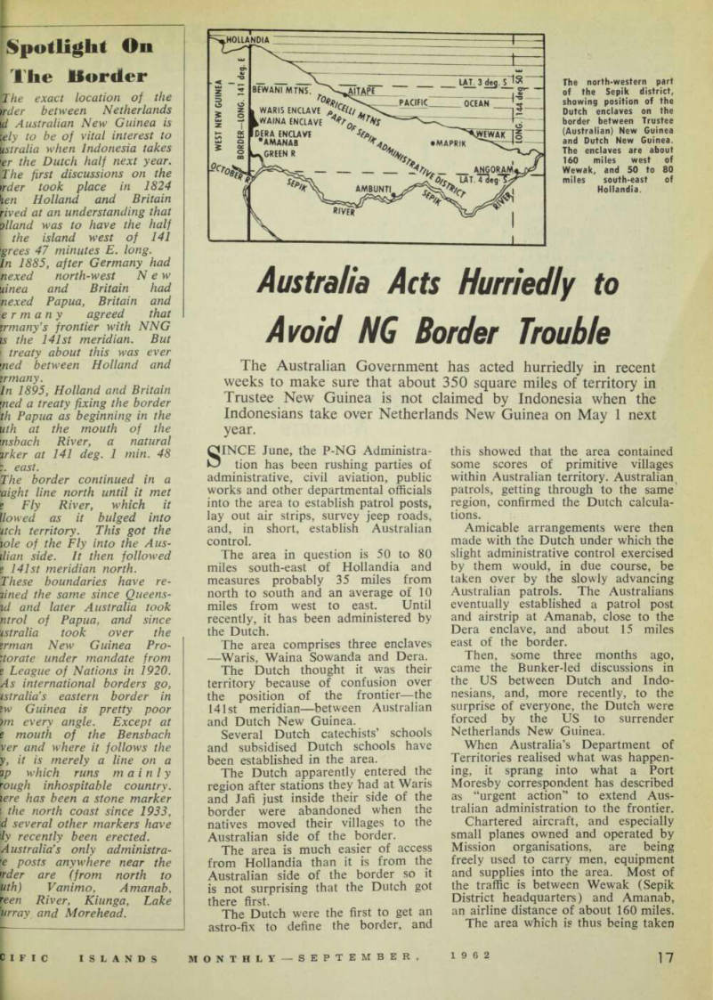
The north-western part of the Sepik district, showing position of the Dutch enclaves on the border between Trustee (Australian) New Guinea and Dutch New Guinea.
The enclaves are about 160 miles west of Wewak, and 50 to 80 miles south-east of Hollandia.