Now in Jap Hands
p. 13 · Read in the full issue
Explorer "Bill"
Korn
rwas reported in the May “PIM,” from information received in Sydney, that Mr. W. Korn, was taken prisoner by the Japanese in July last, and later was shipped away from New Britain to a northern prisoner-of-war camp. His wife, Mrs. W. T. Korn, of Simla Guest House, Leura, New South Wales, has had little news in the last 12 months and would like to contact any of his friends who have escaped from New Britain.
She was notified recently, by the Red Cross, that he was taken from Pondo (New Britain) last July and put to mend ing telephone lines in Rabaul, and that he was last seen there in September. ‘‘Bill” Korn is one of the best-known men in the out-ports of New Guinea. It was he who, about 1927, pegged “Golden Ridges,” on the Morobe goldfield, and in 1936-37 he was a member of the Ward Williams expedition, which spent almost a year prospecting for gold in Central
New Guinea. He left Port Moresby with three other members of the party in July, 1936, for a base 550 miles U P River, and, after several months, the party reached a huge, practically un mapped area lying around the inter section of the boundaries of Dutch New Guinea, Papua and the Mandated Terri tory.
When on leave in Sydney, at the be ginning of 1938, Mr. Korn described the area as a vast region of extensive valley systems, lying at an average height of 5,000 feet, and very numerously inhabited by many tribes of clean-skinned, intelli gent, healthy and friendly natives. In a saucer-like depression between the ranges, just within the borders of the Mandated Territory, Mr. Korn and his companions found a small stream, which they proved to be the actual source of the mighty Sepik. A few miles away, southwards, there was another small stream—the beginning of the equally mighty Fly. They estimated that, from that point, the Sepik flows 850 miles north to the Pacific and the Fly 600 or 700 miles south to the Gulf of Papua.
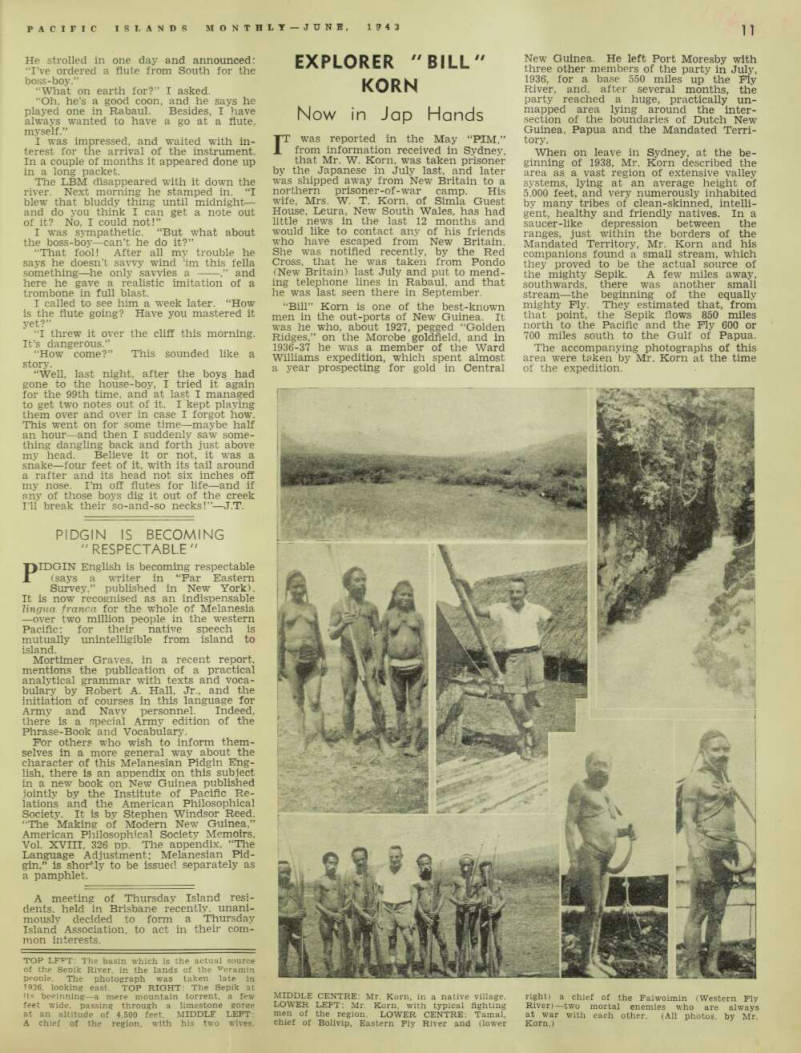
The accompanying photographs of this area were taken by Mr. Korn at the time of the expedition.
TOP LEFT: The basin which is the actual source of the Seoik River, in the lands of the Feramin peonle. The photograph was taken late in 1936. looking east. TOP RIGHT: The Sepik at its beginning—a mere mountain torrent, a few feet wide, passing through a limestone gorge at an altitude of 4,500 feet. MIDDLE LEFT: A chief of the region, with his two wives.
MIDDLE CENTRE: Mr. Korn, in a native village.
LOWER LEFT: Mr. Korn, with typical fighting men of the region. LOWER CENTRE: Tamal, chief of Bolivip, Eastern Fly River and (lower
right) a chief of the Faiwoimin (Western Ply River) —two mortal enemies who are always at war with each other. (All photos, by Mr.
Korn.)