By ski-plane
p. 33 · Read in the full issue
to NZ’s snow topped roof
By Roy Sinclair
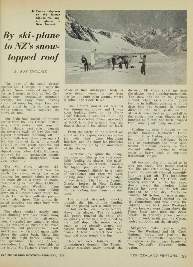
The door of the small aircraft opened and I stepped out onto the glacier. Snow crunched under my feet as I turned to look at New Zea land’s most spectacular mountain scenery, far away from hustling cities and noisy highways. Four ski planes stood in line on the snow while tourists busily captured the views on film.
Our flight had started 40 minutes earlier from the Fox Glacier airstrip, only a few miles inland from the South Island’s west coast, beneath the towering peaks of New Zealand’s highest mountains. Zooming off the ground with four other passengers I felt the thrill of flying in a small aircraft as the green pastures and bush of South Westland quickly slipped away below. Lake Matheson, renewed for its spectacular moun tain reflections, disappeared from view behind us.
The Mt Cook Airlines ski equipped Cessna aircraft flew to wards the coast, using the extra distance for enough height to cross the main divide, a range of moun tains soaring to more than 11,000 ft which separates Westland from Canterbury. We were soon looking down on Gillespies Beach where the rough Tasman Sea endlessly pounds the shingled shore. This almost de serted coastline was once busy with gold prospectors.
The plane banked steeply and, still climbing, flew back inland along the western side of the high moun tains. I steadied my camera as close to the window as possible to avoid reflections and photographed Cook and Tasman which stood majestically above the dense bush. Snow had fallen the night before adding to the splendour. The Fox Glacier, descending from high snowfields to the left of Mt Tasman, ended in the
shade of lush sub-tropical bush. A large stream wound its way from the ice out onto open country where it joined the Cook River.
The aircraft moved on towards the shimmering snows and I was soon looking down on the Franz Josef Glacier, a vast six mile long ice-flow descending from snowfields at 9,000 ft to the terminal face less than a thousand feet above sea level.
From the safety of the aircraft we could see the gaping crevasses in the ice with their deep blue-green interiors, and the sharp ice pinnacles thrust into the air by the movement of the glacier.
I continued to capture the chang ing scene on film as the vast snow fields feeding the glacier (the neve) passed slowly underneath. Towards the highest point of the flight the aircraft bumped slightly in a patch of turbulence and then we were looking down on razor-sharp ridges of the divide. The 18-mile Tasman Glacier, longest in New Zealand, came into view. A ski-plane was on the ice looking tiny from this dis tance.
The aircraft descended quickly towards the high-altitude landing field and passed over a small moun tain hut perched on a rocky outcrop above the glacier. The retractable skis gently touched the snow and we quickly came to a stop, aided by the uphill slope. The motor roared again as the aircraft turned and parked behind the two other ski planes. A fourth aircraft flew over head and soon joined the line.
Here we were, tourists in the mountaineer’s domain. The Tasman Glacier stretched away towards the
distance. Mt Cook stood up from the glacier like a towering monument.
The snow and ice on the glorious summit, which soars to over 12,000 feet, is in brilliant contrast with the deep blue sky beyond. In another direction, the twin peaks of the Minarets descended in an ice-fall to the glacier, the huge blocks of ice jumbled as if they had been dropped from some giant flying machine.
Shading my eyes, I looked up the glacier towards Hochsetter Dome and the ridge leading up to Elie-de- Beaumont. I felt privileged being able to photograph the most spec tacular mountain scenery in New Zealand without having to sweat under a heavy pack or negotiate treacherous ridges.
All too soon the pilot called us to take our seats. The motor roared into life and after racing down the glacier the aircraft climbed smoothly into the clear air. The forbidding Caroline Face of Mt Cook, only recently climbed for the first time, slowly passed the window. Lake Pukaki lay down to the left and extended to the dry Mackenzie Country. Mt Sefton, a large triangu lar pinnacle, slipped behind as we left Canterbury and flew above the Copland Pass back into Westland.
Before long we were flying above the Franz Josef and then the dense forests. The friendly green pastures raced up underneath and the Cessna landed smoothly on the airstrip.
Ski-planes make regular flights from the Westland and Mt Cook National Parks, and provide the visitor with an excellent opportunity to experience the rugged beauty of New Zealand’s foremost alpine region.
• Cessna ski-planes on the Tasman Glacier, the long est glacier in New Zealand.