On the track of Torres
p. 58 · Read in the full issue
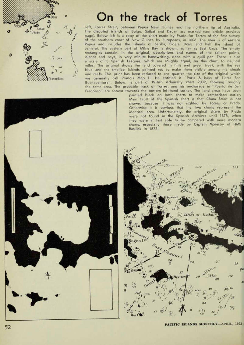
Left, Torres Strait, between Papua New Guinea and the northern tip of Australia.
The disputed islands of Boigu, Saibai and Dauan are marked (see article previous page). Below left is a copy of the chart made by Prado for Torres of the first survey of the southern coast of New Guinea by Europeans, in 1606. The area is of eastern Papua and includes the islands of Sariba, Sideia, Doini and half the island of Samarai. The eastern part of Milne Bay is shown, as far as East Cape. The empty rectangles contain, in the original, descriptions and names of the salient points, islands and bays, in very minute handwriting, done with a quill pen. There is also a scale of 3 Spanish Leagues, which are roughly equal, on this chart, to nautical miles. The original shows the land covered in hills and green trees, with the sea blue and the smallest islands painted red to make them visible among the shoals and reefs. This print has been reduced to one quarter the size of the original which we generally call Prado's Map II. He entitled it "Ports & bays of Tierra San Buenaventura". Below, is part of British Admiralty chart 2032, showing roughly the same area. The probable track of Torres, and his anchorage in "Puerto de San Francisco" are shown towards the bottom left-hand corner. The land areas have been
painted black on both charts to make comparison easier.
Main fault of the Spanish chart is that China Strait is not shown, because it was not sighted by Torres or Prado.
Otherwise it is obvious that the two charts represent the identical area. Unfortunately, the original charts by Prado were not found in the Spanish Archives until 1878, when they were at last able to be compared with more modern charts, especially those made by Captain Moresby of HMS Basilisk in 1873.