Mysteries Of
pp. 99-100 · Read in the full issue
The Bass
Islands
If you cast your eye over a map of the South Pacific, find Tahiti, and run your finger downwards an inch or two to the south-west, you may or may not find a scarcely visible dot labelled Bass Islands, or, per
haps, Marotiri.
THE Bass Islands (alias Marotiri) are not the sort of islands that most cartographers bother about.
They consist merely of nine rocky crags, jutting out of the sea like giant fingers. They are miles from anywhere (lonely Rapa, 50 miles to the west is their nearest neighbour); nobody lives on them; and few people, apart from the Rapans, ever visit them or even sail past them.
Yet for anyone who likes to worry his head with intriguing, but profitless problems, the Bass Islands have a lot to recommend them.
For one thing, no one has yet been able to establish with certainty who the European discoverer of the Bass Islands was, nor how they came to get on the map for the first time.
George Bass
Sailing directories and handbooks on the Pacific usually attribute their discovery to George Bass, the dis coverer of Bass Strait, who made a voyage to the Eastern Pacific in the brig Venus at the turn of the 19th century in quest of salted pork for the infant colony of New South Wales.
Bass, however, seems never to have been any closer than about 400 miles to the islands that bear his name.
On his outward voyage from Sydney, it is on record that he left Dusky Bay, New Zealand, on December 21, 1801; that he “dis covered an island near Tubuai” on January 13, 1802, and stayed there for two days; and that he reached Tahiti on January 24.
Details of his homeward voyage are less explicit, but it is known that he left Tahiti for Moorea on August 19, 1802; that he called at other islands in the Society Group, Samoa and the Friendly Islands, and reached Sydney on November 14, 1802.
Tubuai, or the island near it— probably Rurutu or Raivavae—there-
fore seems to have been Bass’ nearest landfall to the Bass Islands, and that is some 400 miles away.
So why are the Bass Islands called what they are? By whom were they discovered? And when?
Australian author Frank Clune raised these intriguing questions in his recent book Journey to Pitcairn (P/M, Jan., p, 105) without being able to solve them. Now another author, Edwin Ferdon, has raised an even more baffling one about those same islands.
Ferdon, an American archaeologist, was a member of Thor Heyerdahl’s archaeological expedition to Easter Island and the Eastern Pacific, which Heyerdahl described in his best selling book Aku-Aku some 10 years ago.
Ferdon’s book. One Man's Log, is an extremely belated account of the same expedition; and while it is not in the same literary street as Heyerdahl’s often-exciting story, it does contain some interesting material that Heyerdahl did not touch on at all.
Ferdon describes, for example, how the expedition visited the Bass Islands after several men on Rapa (where the expedition conducted an extensive “dig”) had insisted that archaeological remains were to be found there.
“The morning was delightfully clear as we approached the Marotiri
(Bass) islets,” Ferdon says.
“It was immediately apparent that eight of the nine pinnacles could not possibly contain anything archaeological, for they rise sheer from the water and their tops have no real surface.
“This is not true, however, for the remaining islet. It is far more massive than the others, and instead of rising in a single peak, it has two tall pro jections with a broad saddle between.
“Its sides are excessively steep, but around its base is a wave-cut terrace, the outer edge of which drops abruptly into the sea.”
Ferdon says that the archaeological remains are on the saddle of this
sheer rock, and that sevei members of the Heyerdahl expedite landed on it and climbed to t ruins, where they mapped, measur and sketched what they found.
Some of the buildings were 1c platforms, but others had been bu up high to form miniature towe: It was by no means clear what th< purpose was.
Although they had probably be used as lookouts in times of dang( it seemed that they might also ha had a religious function.
In fact, Ferdon believes that ti towers may have started off as lo religious platforms, and, when the secondary value became apparent years of strife, they rose in heig to become towers.
Whatever their function, “th must certainly have been designed f temporary use”, Ferdon says, “f there is no fresh water, no soil f gardening, and . . . not even a bead on the island on which they stand
Spelling errors
About half of Ferdon’s 200-pa; book deals with Easter Island. Ti rest is divided fairly equally betwe< the Galapagos Islands, Pitcair Mangareva, Raivavae, Rapa ai Tahiti.
A noteworthy feature of the boc -—and this is almost a recommend tion—is that it contains more spellii errors than any book this review* has ever read.
The author spells words with Shakespearean disregard for tl dictates of dictionaries or commc usage, and the publishers, eitb through awe, ignorance, laziness ( pressure of work, have not brush* him up for the “gentle reader”.—R] (ONE MAN’S LOG. George Allen ai Unwin. $5.15. Our copy from Australasis Publishing Co. Ltd., Sydney.)
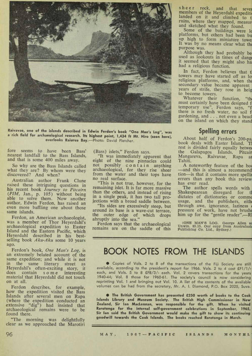
Raivavae, one of the islands described in Edwin Ferdon's book "One Man's Log", was a rich field for archaeological research. Its highest point, 1,434 ft Mt. Hiro (seen here), overlooks Raiurua Bay. Photo: David Fletcher.