A Volcanologist
pp. 84-85 · Read in the full issue
Day’S Work For
By V. H. Friedlander
WE left the DCA Marine base in the crash boat at 8.30 a.m.
On board were John Best, the vulcanologist; his native assistant, Leslie Topue; the skipper, Jim Ferguson; two native crew members, and myself.
We threaded our way between some small craft and past the wreck of the Naruta, heading in the direc tion of the Beehives, two precipit ous rocky protuberances rising sheer out of the harbour, the taller of them over 160 feet above the water, the lower about half its height.
“I don’t know,” said John, “how the tale started, but many people believe that the Beehives came up during the ’37 eruption. They were in existence as far back as we know.”
I was learning things.
Fifteen minutes later, we anchored 25 yards oflshore, at the foot of Vulcan, in a tiny inlet. John, Leslie Topue, and I were rowed ashore in the dinghy we had towed behind.
We walked inland over crunchy, loosely packed soil strewn with fawn coloured pumice, and John gave me a few facts about Vulcan.
“The initial eruption in 1937 occurred in this area,” he said. “It began on a Saturday afternoon, and it was not till Sunday that Matupi went into action. Vulcan, as we know it now, was non-existent then.
What had been a small island, separated by several hundred yards from the mainland, built itself up across the water till it formed a peninsula.
“The mountain is rapidly eroding.
When it was first built up, its peak was 760 feet high. Now it is 540 feet. The earth washed down by the rains formed the beach we’re
walking on now. A couple of years ago there was a wrecked Jap coastal boat at the head of this inlet with part of its rigging and upper structure showing. Now it’s com pletely covered over.”
We halted about 150 yards inland, beside a small open pipe leading down into the ground. Leslie Topue lowered a thermometer on the end of a line into the vent, which was about three feet deep and reached a spring running under ground from the higher slope.
Leslie Topue was awarded the BEM for his work in the Mount Lamington area after the eruption there. One of his jobs then had been to move, every half hour, the revolving drum on the machine re cording the tremors. Tremors were so frequent that, had the roll not been moved by hand at intervals, the needle recordings would have overlapped and been impossible to read. Toque carried out that job for a month, without ever missing a half-hourly change. John Best described him as the “most re liable and versatile native assist ant I have ever had.”
The temperature in the vent was 471 degrees Centigrade . . . equiv alent to 118 degrees Fahrenheit.
“That’s normal,” said John. “It gives us an indication of how things are further up the hill. Saves us walking to the top every time. We do make at least one check every month inside the crater.”
We looked up the steep, foliage covered rise, I was glad there was no need to make the climb to the top.
“I’d rather walk up Matupi ten times than up Vulcan once,” John said. “Quite apart from the climb, its crater is twice as hard to get
into and out of. Incidentally, the wasn’t a blade of grass on Vulc£ ten years ago. In years to con when the soil has packed down, tt ground will be unbelievably fertile He picked up a smooth piece pumice as we walked back to t] boat; “It always amuses me, whi I’m down South, to see Chemis shops selling this stuff at sixpen apiece,” he said.
WE have frequently stated in PI that a great many present-d; residents of New Guinea b lieve that history began there 1945. In a note accompanying th article, the author says: “Me people think Matupi was the on erupting volcano in 1937; scarce any mention is ever made of Vu can.”
This is understandable, perhajj because Matupi is still witho' vegetation, still throws off clou, and sulphur fumes; while Vulcs is quiescent, and innocently clothi in green.
However, it was Vulcan whit started the fuss in 1937—befa which is was equally innocent-loo' ing, but an island. It has be* recorded that Vulcan Island and ti Beehives came up during the la eruption of the Mother, in 18"
During the 1937 eruption, the Be: hives subsided a little.
We have it on good authority thi Vulcan did have a blade of grass years ago. Mr. Gordon Thoms who spent 3 years in Rabaul as prisoner of the Japs, says that was barren in 1942 but when thj emerged from internment in 19* Vulvan had grown a green mant: When the eruption occurred 1937, W. R. Carpenter and Co. hi a slipway on Vulcan. A small sh was on the slip when Vulcan we: up and when the eruption w finished the ship was about quarter mile from the sea. T; rights to salvage her went to a Jaj anese or Chinese company and gang of coolies attempted to c the ship out with nothing much the way of equipment but can carrying baskets.
They had given up the job in IS but the ship remained. It is pro; ably this ship which Mr. Best refe to as a “Jap coastal vessel at t; head of the inlet.”
As we were travelling across t: harbour towards Matupi, JoL startled me with another item of ii formation. “Matupi isn’t Matui The correct name is Tavurvur (pn nounced Ta-wuy-wuy,” he said. “B referred to all over the world Matupi, but Matupi is, correcti where Matupi Village is, on Matu Island.”
Matupi, as we approached close with the lower lip of the crat etched against the upper lip in ti background, looked to be an eas
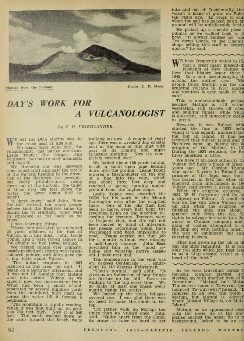
Photo; C. H. Meen.
Matupi from the harbour.
climb. The brown landscape was polka-dotted with patches of kunai, which have come into being only in the last two years.
The foreshores here, as we stepped out of the dinghy, were covered with small brown pebbles of scoria, quite unlike the off-white jebbles near Vulcan. The ground it the base was firm and well jacked.
Jim Ferguson, the skipper, had jome ashore with us. John Best ed the way, I followed, and Jim yas next in line. Leslie Topue was
left to check temperatures in a gully near the bottom before fol lowing us to the top.
We followed a rocky trail rising steeply in a rough semi-circle. The stones were like the blue metal used for road making in Australia, hard and heavy. Occasionally, we skirted large, black rocks up to four feet in diameter, with smooth edges.
These had been flung out during eruptions, in a semi-plastic state.
Many of them, in cooling, had split into several smaller pieces.
About fifteen minutes from the
beach and 200 feet up we passed a small crater, on our right. This was a small steam explosion crater, a minor blow-out during the 1937 eruption.
The track curved left till we topped the ridge of the lower main crater lip, 350 feet above sea level. Before us, some 200 feet down, were three craters, each sep arated from the other by low ridges. They formed a rough circle some 500 yards in diameter.
On the far side, the crater lip was over 700 ft high.
Large and small jets of sulphur fumes escaped from holes in the sides of and at the bottom of the crater. Yellow outcrops and patches of sulphur deposits coloured the inside of this giant melting pot.
We halted at a peg driven into the ground, which had one end of a slim rope tied around it.
John attached a stone to the other end and flung it far into the abyss.
The rope snaked down the steep drop.
“W h a t’s the breaking strain of the rope?” I asked.
“I’m not too sure,” John said, and there was no smile on his face.
“It’d be getting a bit rotten now.”
Grasping it, he slid over the rim.
Going down was easier than I had thought it would be. The rope helped a lot. The crater side was fairly firm and the greatest hazard was the risk of resting one’s hand on or close to one of the numerous small and almost imperceptible blowouts, around which the ground was always scorching hot.
At the bottom, we found our selves in the largest, the 1937, crater. Here, surrounded by the steep sides, there was no breeze, the sun seemed more concentrated, and the sulphur fumes more nauseating.
There was no vegetation here. Soil, washed down from the sides, had silted over the area to form a small level plain, soft and slightly boggy We found this to be the case with the other craters as well.
Across the flat, we climbed the dividing ridge of crumbly, ash coloured pumice into which our shoes bit deeply.
At the top, we found, on our right, the crater from the 1941 eruption, smaller than the first but larger than the crater on our left, which, John told us was believed to be due to an eruption in 1943, during the Japanese occupation of Rabaul. And, on the facing wall, beside the smallest crater was a massive, 30-ft thick, 100-ft tall pillar of solid rock that was the core, or as John called it, the plug of the volcano.
Leslie Topue moved about the three craters taking temperatures from natural fissures in the ground, and recording them in a book.
All the temperatures were around the 100 deg. centigrade mark, with the exception of two which were slightly lower.
“Quite normal,” was John’s com ment.
I gathered a lump of pure sulphur as a souvenir, and we returned the way we had come, to the crater lip.
It was good to breathe fresh air again.
On the way back, I diverted to the 1878 crater which is close to but above the craters we had already inspected. The major portion of this crater has filled in through the years. It is now a shallow depression some 20 feet deep and 200 yards across, bare of growth of any sort.
Lunch on board, and then we visited seven points over a two-mile stretch of beach, travelling towards Rabaul, at which temperatures were taken. All points checked, and with the dinghy bouncing in our wash, we headed for home.
“I’ve been doing this every week for three years except when on leave or working away from Rabaul,” said John. “To-morrow we check Rabalanakai, Rapindik, Sulphur Springs, and Sulphur Creek. Care to come along again?”
Unfortunately, I couldn’t spare the time. I had to write this article. (Who said vulcanologists earned their money the easy way?)
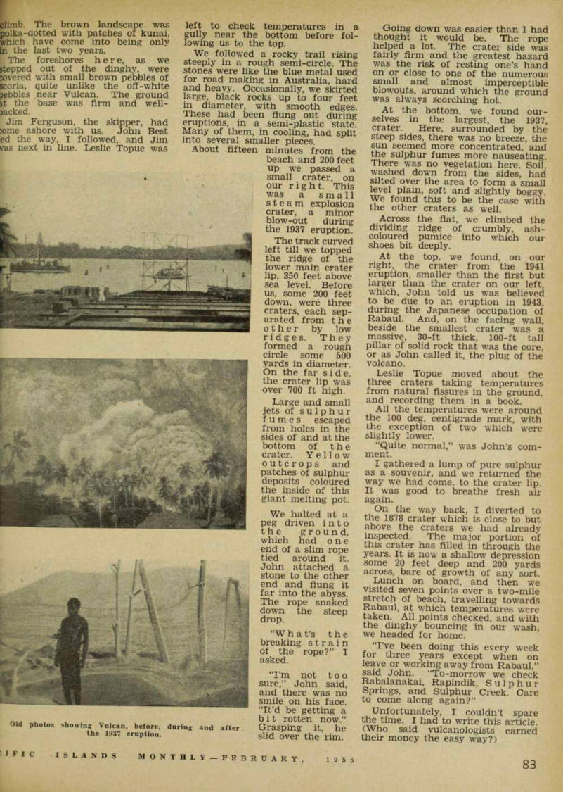
Old photos showing Vulcan, before, during and after the 1937 eruption.