Aerial Photographs
pp. 13-14 · Read in the full issue
Battle For Salamaua
Difficult New Guinea Campaign Explained By
By R. W. Robson
THE battle of Salamaua moves slowly and inexorably to its end. Allied troops are pressing in steadily upon the Jap-held New Guinea port, from the west and the south. Sooner or later, the Japs—if they do not go; and they usually prefer to stand and die—will be exterminated, and another part of New Guinea will be cleared of the enemy.
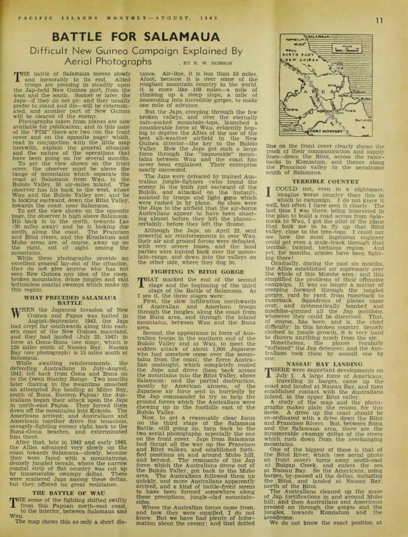
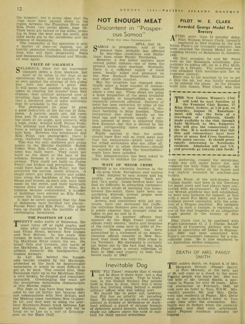
Photographs taken from planes are now available for publication; and in this issue of the “PIM” there are two (on the front cover and on the opposite page) which, read in conjunction with the little map herewith, explain the general situation and the nature of the operations that have been going on for several months.
To get the view shown on the front cover, the observer must be above the S U “ Sjn Ch wT S!
Buk)lo Vafiev air-mUes Intend The oteerver back to the west where
foßulol
islookine Bitoi Valiev towards coast near Sallmaua
2pf SSJL?ST a ’ u,
page the
Sfback isto towardf Lae
00 mfies away) and he is tanking d£ south, along the coast. The Francisco and Bitoi rivers, and the Komiatum and Mubo areas are, of course, away up on the right, out of sight among the mountains While these photographs provide an excellent general lay-out of the situation, they do not give anyone who has not seen New Guinea any idea of the steep, broken mountains, dense jungles and vast bottomless coastal swamps which make up this region.
What Preceded Salamaua
Battle
Wtt-1-.wt j■. t , „ HEN the Japanese invasion of New Guinea and Papua was halted in i j August-September, 1942, the Japs had crept far southwards along this eastern coast of the New Guinea mainland, and they had landed (July 22, 1942) m force at Gona-Buna (see map), which is 120 miles south of Nassau Bay. Nassau Bay (see photograph) is 15 miles south oi Salarr aua - ... . , .
While awaiting reinforcements, the A , ust / ln J^y-Au Sust, 1942 fell back from Gona and Buna on to the Owen Stanley Range Two months later (having m the meantime smashed an attempted Jap landing at Milne Bay, south of Buna, Eastern Papua) the Austrahans began their attack upon the Japs m north-east Papua. They forced them down off the mountains into Kokoda. Tne Americans arrived: and Australians and Americans together drove the tenacious, savagely-fighting enemy right back to the Buna.-G°na beaches, and exterminated i , i mAo Aflate “} 1942 al f d f arly 1943 ’ the Allies advanced very slowly up the coast towards Salamaua slowly, because they were faced with a mountainous, terrain. where the narrow coastal strip of flat country was cut up de |tajf There Japs among these deltas, but they, offered no great resistance.
The Battle Of Wau
mHE scene of the fighting shifted swiftly . Pa P^ a P north-east coast, to the interior, between Salamaua and wa £- , ... . The map shows this as only a short dis-
tance. Air-line, it is less than 50 miles, Afoot, because it is over some of the roughest mountain country in the world, it is more like 100 miles—a mile of climbing up a steep slope, a mile of descending into incredible gorges, to make one mile of advance, But the Japs, creeping through the few broken valleys, and over the eternally rain-soaked mountain-tops, launched a considerable force at Wau, evidently hop ing to deprive the Allies of the use of the best all-weather airfield in the New Guinea interior—the key to the Bulolo Valley. How the Japs got such a large force through the “impassable” moun tains between Wau and the coast has never been explained. Their enterprise nearly succeeded The Japs were defeated by trained Aus tralian jungle-fighters (who found the enemy in the bush J ust eastward of the o, and attacked on the instant), assisted by tro °P s and n g ht guns which were rushed in by plane - So close were the Japs to the airfield that the air-borne Australians appear to have been shoot ing almost before they left the P lanes ce »’ be (° re ‘ hey ,eft the ’ drome - Although the Japs, on April 22, sent powerful air reinforcements in over Wau, their air and ground forces were defeated, with very severe losses, and the land parties were hunted back over the moun tain-range, and down into the valleys on other side, where they dug in.
FTfIITTOr RTTrkT rnprp
Lighting In Bitoi Gorge
rpHAT marked the end of the second X stage and the beginning of the third stage of the Battle of Salamaua. As 1 fee J be tbree ? ta ff s were: First, the slow infiltration northwards of Australian and American troops through the jungles, along the coast from the Buna area, and through the inland mountains, between Wau and the Buna area.
Second, the appearance in force of Aus tralian troops in the southern end of the Bulolo Valley and at Wau, to meet the sudden attack of about 1,000 Japanese who had somehow come over the moun tains from the coast; the fierce Austra- Han onslaught, which completely routed the Japs and drove them back across the mountains into the Bitoi Valley, above salamaua; and the partial destruction, most i y b y American airmen, of the Japanese air force sent in hurriedly by the Jap commander to try to help the ground forces which the Australians were chewing up in the foothills east of the Bulolo Valley Now> to get a reasonably clear focus on the third stage of the Salamaua Battle, still going on, turn back to the two aerial photographs, especially the one on the front cover. Japs from Salamaua had thrust all the wav up the Francisco and Bitoi vaUeys and established forti fied positions on and around Mubo hill, and beyond. The remnants of the Jap force . which the Australians drove out of the Bulolo Valley, got back to the Mubo area The Australians followed them up quickly, and more Australians apparently arrived, and a kind of battle-front seems to bave been formed somewhere along Precipitous. Jungle-clad mountain- Where the Australian forces came from, and how they were supplied, I do not know. But we have had plenty of inf or mation about the enemy; and that dotted
Terrible Country
I COULD not, even in a nightmare, imagine worse country than this in which to campaign. I do not know it well, but often I have seen it closely. The last time I was there, being interested in the plan to build a road across from Sala maua to Wau, I got the pilot of the plane that took me in to fly up that Bitoi valley, close to the tree-tops. I could not see how the most ingenious engineer could get even a mule-track through that terrible, twisted, tortuous region. And yet, for months, armies have been fight ing there!
Gradually, during the past six months, the Allies established air supremacy over the whole of this Morobe area; and this simplified the problems of their offensive campaign. It was no longer a matter of creeping forward through the jungled gorges, yard by yard, from razorback to razorback. Squadrons of planes came over, and systematically bombed and machine-gunned all the Jap positions, wherever they could be discerned. That, of course, has been, and is. the chief difficulty: in this broken country, densely clothed in jungle growth, it is very hard to discern anything much from the air.
Nonetheless, the planes regularly “softened” the Jap defences; and the Aus tralians took them by assault one by one.
Nassau Bay Landing
THERE were important developments on July 1. A large force of Americans, travelling in barges, came up the coast and landed at Nassau Bay, and then established contact with the Australians inland, in the upper Bitoi valley.
A study of the map and the photo graphs makes plain the reason for this move. A drive up the coast should be co-ordinated with a drive down the Bitoi and Francisco Rivers. But, between Buna and the Salamaua area, there are the innumerable swampy deltas of the rivers which rush down from the overhanging mountains.
One of the biggest of these is that of the Bitoi River, which (see aerial photo on front cover) turns away south-east at Buigap Creek, and enters the sea at Nassau Bay. So the Americans, using barges, by-passed all the deltas, including the Bitoi, and landed at Nassau Bay, north of the Bitoi.
The Australians cleaned up the maze of Jap fortifications in and around Mubo hill; and then Australians and Americans pressed on through the gorges and the jungles, towards Komiatum and the areodrome.
We do not know the exact position at
line on the front cover clearly shows the track of their communication and supply lines—down the Bitoi, across the razor backs to Komiatum, and thence along the Francisco valley to the aerodrome south of Salamaua.
the moment; but it seems clear that the.
Japs have been pinned down In the region between the Francisco River and Kila Point (see aerial photo, page 10).
Their faces are turned to the Allies, press ing in from the west and the south, and their backs are to the aerodrome and the isthmus of Salamaua.
The remainder of the operation is only a matter of time —of digging, out of heavily protected foxholes, fanatical little Japs who will fight desperately. Buna and Sanananda, Guadalcanal and Munda, all over again.
Value Of Salamaua
SALAMAUA, since our air supremacy clamped down a firm blockade, lost most of its value to the Japs as an operational base; and its capture by us, as seen against the strategy of this global war, does not matter a great deal.
It will mean that another step has been taken in clearing the invader from New Guinea; that another advanced nest of invading Japs has been wiped out; and that a sheltered port of some usefulness may be available to the Allies.
The photogrpah on page 10 gives a good indication of the lay-out of Sala maua. A narrow, sandy spit, 500 yards long and 70 yards wide, runs out from the shore at an angle, and connects with a high, rocky, wooded bluff, Parsee Point.
The isthmus and Parsee Point, together, form a natural breakwater, less than a mile long. Between this breakwater and Kila Point (see photograph) there is deep, sheltered water (Samoa Harbour).
This was the only sheltered port giving access to the Morobe Goldfield (Bulolo Valley, Wau, Edie Creek, etc.), so a little town was built there. They could not build on the shore at the base of the isthmus, because it is mostly mangrove swamp. They could not build on Parsee Point—too broken and precipitous. They could have built on Kila Point; but they preferred the narrow, sandy isthmus. A single street, gay with crotons and palms, runs along the backbone of the isthmus.
Shops and houses, on each side, have their noses on the street, and their backyards runing down into salt water. When the isthmus became overcrowded, a number of buildings were erected on Kila Point, across the little harbour.
It may be safely assumed that the Japs at Salamaua have fortified two places— Parsee Point and Kila Point. The latter runs up sharply into the foothills of the overhanging mountains.
The Position Of Lae
TWENTY miles north of Salamaua, the coast turns off at right angles, and runs away eastward to Finschhaven and Vitiaz Strait, between New Guinea and New Britain. In the angle thus formed, 20 miles north of Salamaua, the big Markham River enters the sea. On broad flats and terraces, just north of the Markham, is Lae, with its wide, dry airfield, formerly the headquarters of Guinea Airways.
As Lae lies behind the formid able barrier created by the Markham, protected at the back by impenetrable mountains, it would be most difficult to get at, by land. The coastal area, from Salamaua right up to the Markham River, is very broken, be-jungled and completely unroaded. Overhanging the coast are the precipitous mountains characteristic of this Morobe region.
The Japs at Lae have long been block aded by our air forces; but, because they can communicate with New Britain and the Madang coast (northern New Guinea) by air, and they may be using the over land Markham-Ramu track between Lae and Madang, they probably will try to hang on to Lae as a sort of listening post on the Huon Gulf.