In Solomons Area
pp. 21-23 · Read in the full issue
Use Of Mota
From Our Own Correspondent
Noumea, Feb. 18.
PHRASES from the Mota language of the Banks Group, lingua franca of the Melanesian mission for over 70 years, and therefore spoken on 50 islands of the Solomons, Santa Cruz and New Hebrides, are being added to a booklet which should prove of great use to avia tors forced to bale out over South-west Pacific areas.
The list was compiled during a visit to the Solomons by New Zealand chaplain D. L. Francis, who has spent his working life in this area. Though Pidgin English is coming into ever-greater use, he says that Mota still holds its own and usually, in a group of natives, you find
at least one or two who understand it.
Here is what the language looks like: “I kamam talo America wa ra pulsalama, we van ma iake sia pirin kamiu site vure lue ira ta Japan.” Being interpreted, this means: “We Americans are your friends and have come to help drive away the Japs.”
Chaplain Francis, who is attached to a New Zealand field ambulance unit in New Caledonia, went to the Solomons to see the Bishop of Melanesia (Bishop W.
Baddeley). He found Tulagi, Gavutu and Lunga much torn by shells and bombs.
He said that all the Melanesian mis sion women are gone from the Solomons, the last to leave being Mrs. Sprott, from Ysabel. The Bishop is working to get the missions going again as soon as the Japs are pushed out. Relations between the Americans and the natives are excellent.
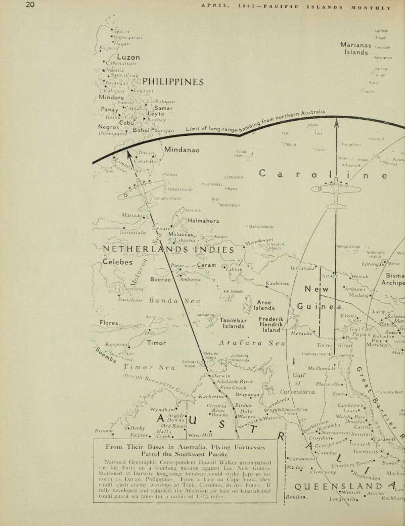
From Their Bases in Australia, Flying Fortresses Patrol the Southwest Pacific National Geographic Correspondent Howell Walker accompanied the big Forts on a bombing mission against Lac, New Guinea.
Stationed at Darwin, long-range bombers could strike Japs as far north as Davao, Philippines. From a base on Cape .York, they could reach enemy warships at Truk, Carolines, in five hours. If fully developed and supplied, the American air base on Guadalcanal could guard sea lanes for a radius of 1,500 miles.
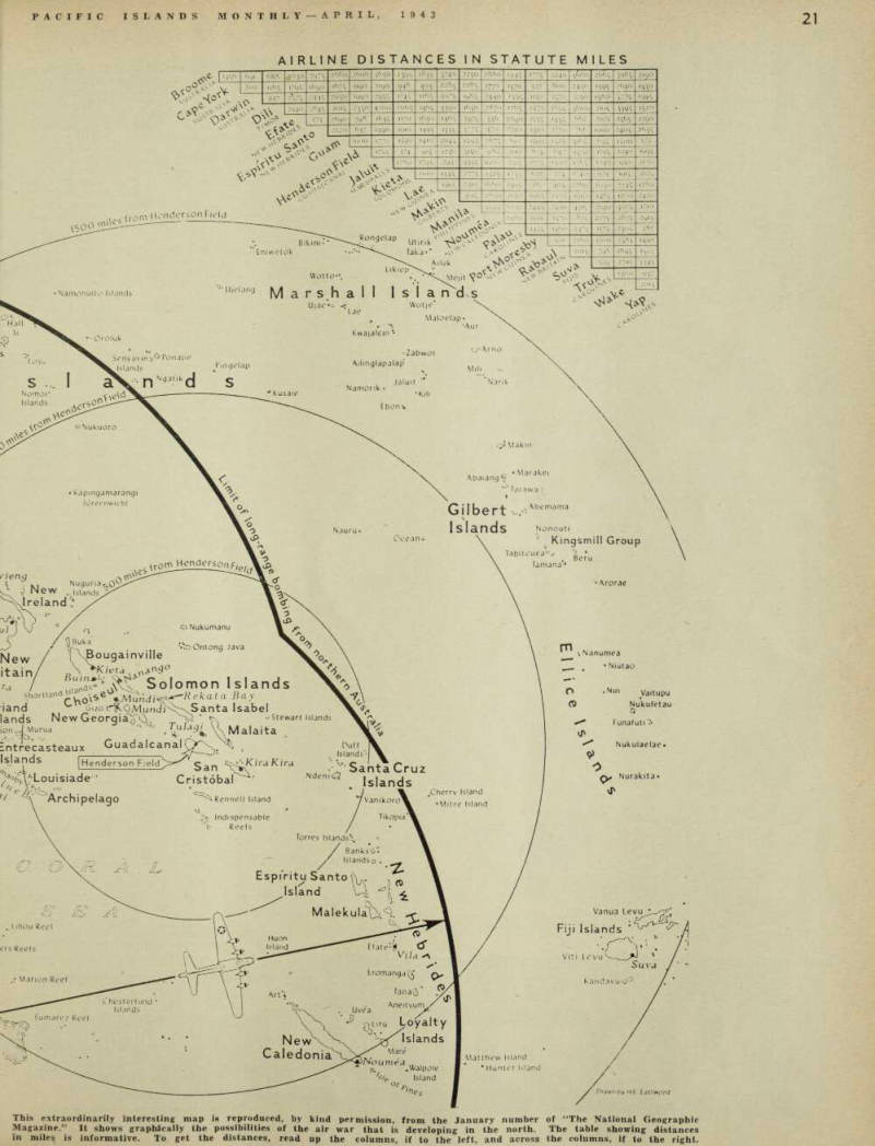
Airline Distances In Statute Miles
This extraordinarily interesting map is reproduced, by kind permission, from the January number of “The National Geographic Magazine." It shows graphically the possibilities of the air war that is developing in the north. The table showing distances in miles is informative. To get the distances, read up the columns, if to the left, and across the columns, if to the right.