Shown By Map
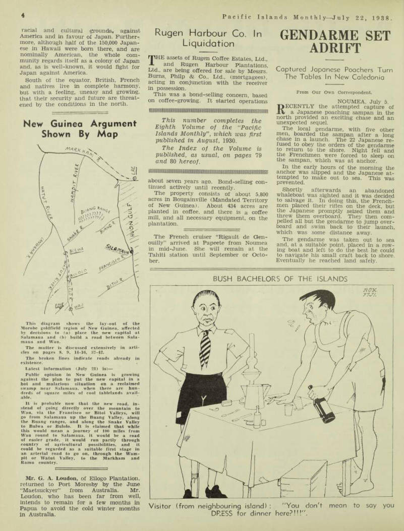
New Guinea Argument Shown By Map
This diagram shows the lay-out of the Morobe goldfield region of New Guinea, affected by decisions to (a) place the new capital at Salamaua and (b) build a road between Sala maua and Wau.
The matter is discussed extensively in arti cles on pages 8. 9, 14-16, 87-42.
The broken lines indicate roads already in existence.
Latest information (July 21) is:— Public opinion in New Guinea is growing against the plan to put the new capital in a hot and malarious situation on a reclaimed swamp near Salamaua, when there arc hun dreds of square miles of cool tablelands avail able.
It is probable now that the new road, in stead of going directly over the mountain to Wau, via the Francisco or Bitoi Valleys, will go from Salamaua up the Buang Valley, along the Buang ranges, and along the Snake Valley to Bulwa or Bulolo. Tt is claimed that while this would mean a journey of 100 miles from Wau round to Salamaua, it would be a road of easier grade, it would run partly through country of agricultural possibilities, and it could he regarded as a suitable first stage in an arterial road to go on, through the Warn pit or Watut Valley, to the Markham and Ramu country.
Mr. G. A. Loudon, of Eilogo Plantation, returned to Port Moresby by the June “Maetsuckyer” from Australia. Mr.
Loudon, who has been far from well, intends to remain for a few months in Papua to avoid the cold winter months in Australia.