Activity In Dutch New Guinea
pp. 44-46 · Read in the full issue
Article and maps supplied by Dr. W. C. Klein, of the New Guinea Committee, The Hague, under date April, 1937.
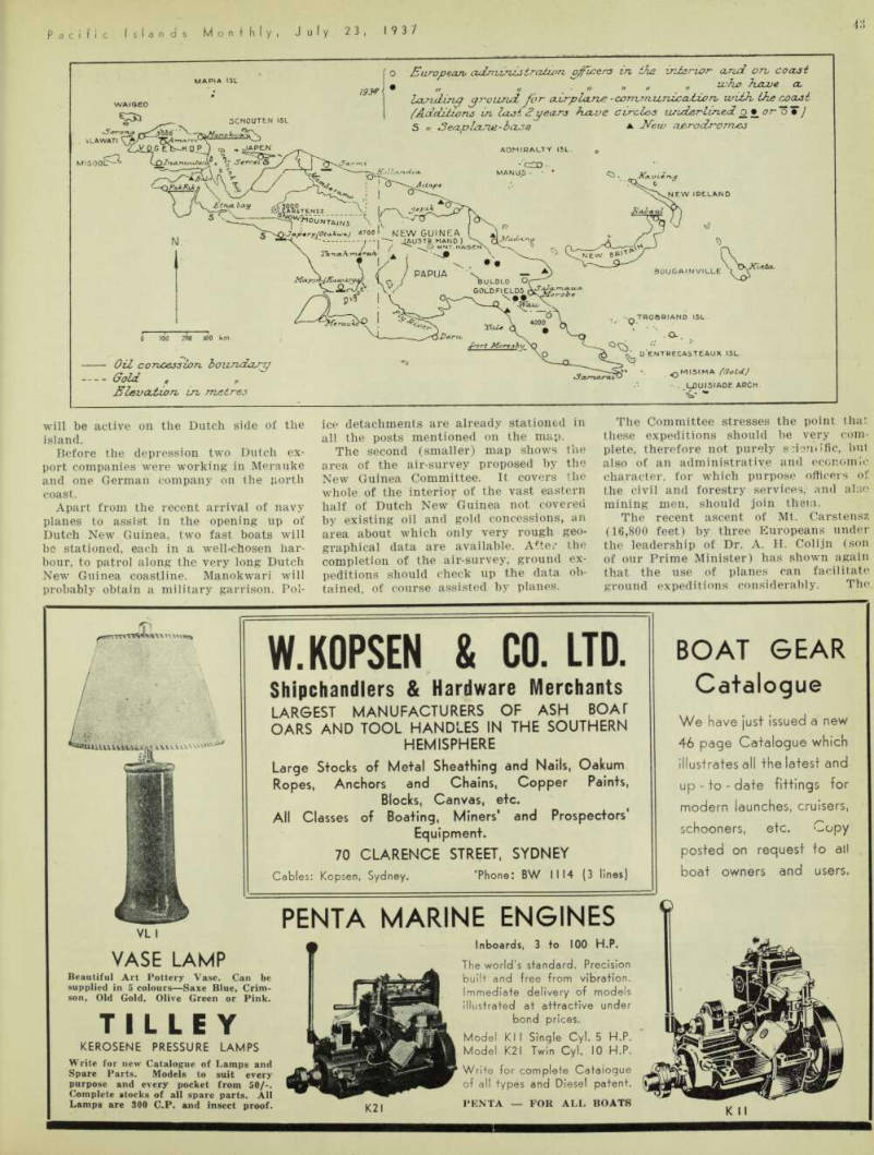
T i HE map on the adjoining page shows * the extent of Government influence in both halves of the vast island of New Guinea.
In the Dutch half, it has rapidly in creased in the last two years, as shown by the thick horizontal line marking new posts. We can now boast of two stations in the interior, Tanah Merah and Amaroe, and both can be visited by
seaplanes of the navy.
These planes have now been stationed permanent ly in the Moluccas and often carry Government officers on their trips.
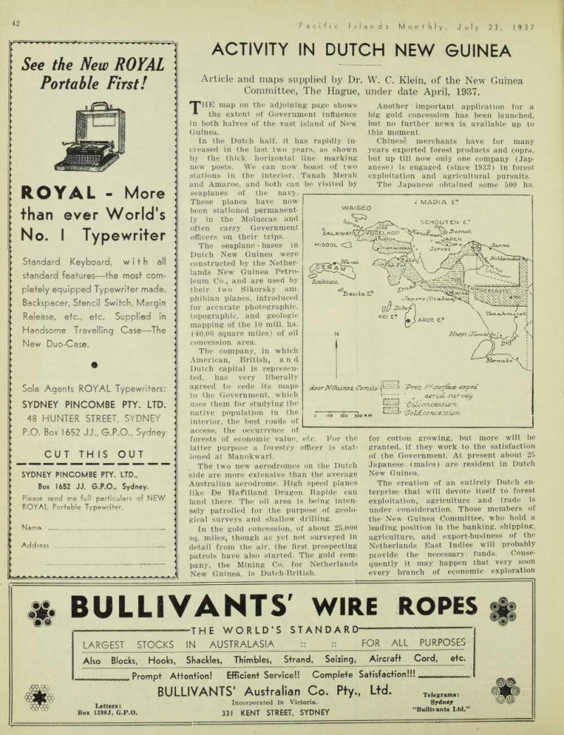
The seaplane - bases in Dutch New Guinea were constructed by the Nether lands New Guinea Petro leum Co., and are used by their two Sikorsky am phibian planes, introduced for accurate photographic, topographic, and geologic mapping of the 10 mill. ha. (40,00 square miles) of oil concession area.
The company, in which American, British, and Dutch capital is represen ted, has very liberally agreed to cede its maps to the Government, which uses them for studying the native population in the interior, the best roads of access, the occurrence of
forests of economic value, etc. For the latter purpose a forestry officer is stat ioned at Manokwari.
The two new aerodromes on the Dutch side are more extensive than the average Australian aerodrome. High speed planes like De Hatfilland Dragon Rapide can land there. The oil area is being inten sely patrolled for the purpose of geolo gical surveys and shallow drilling.
In the gold concession, of about 25,000 sq. miles, though as yet not surveyed in detail from the air, the first prospecting patrols have also started. The gold com pany, the Mining Co. for Netherlands New Guinea, is Dutch-British.
Another important application for a big gold concession has been launched, but no further news is available up to this moment.
Chinese merchants have for many years exported forest products and copra, but up till now only one company (Jap anese) is engaged (since 1933) in forest exploitation and agricultural pursuits.
The Japanese obtained some 500 ha.
for cotton growing, but more will be granted, if they work to the satisfaction of the Government. At present about 25 Japanese (males) are resident in Dutch New Guinea.
The creation of an entirely Dutch en terprise that will devote itself to forest exploitation, agriculture and trade is under consideration. Those members of the New Guinea Committee, who hold a leading position in the banking, shipping, agriculture, and export-business of the Netherlands East Indies will probably provide the necessary funds. Conse quently it may happen that very soon every branch of economic exploration
will be active on the Dutch side of the island.
Before the depression two Dutch ex port companies were working in Merauke and one German company on the north coast.
Apart from the recent arrival of navy planes to assist in the opening up of Dutch New Guinea, two fast boats will be stationed, each in a well-chosen har bour, to patrol along the very long Dutch New Guinea coastline. Manokwari will probably obtain a military garrison. Pol
ice detachments are already stationed in all the posts mentioned on the map.
The second (smaller) map shows the area of the air-survey proposed by the New Guinea Committee. It covers the whole of the interior of the vast eastern half of Dutch New Guinea not covered by existing oil and gold concessions, an area about which only very rough geo graphical data are available. After the completion of the air-survey, ground ex peditions should check up the data ob tained, of course assisted by planes.
The Committee stresses the point that these expeditions should he very com plete, therefore not purely soieriiific, but also of an administrative and economic character, for which purpose officers of the civil and forestry services, and also mining men, should join them.
The recent ascent of Mt. Carstensz (16,800 feet) by three Europeans under the leadership of Dr. A. H. Colijn (son of our Prime Minister) has shown again that the use of planes can facilitate ground expeditions considerably. The.
results have taught us that if aviation is used also for the supply of food to the surface-expeditions, following the air re connaissance, a bigger number of Euro peans than usual in such circumstances can join the parties and much less car riers are required.
The area shaded by horizontal lines is the first to come into consideration for ground-expeditions. It is already known that its population is relatively dense, and recently a lake has been discovered in its centre by the Netherlands Indian Airways, that carried out extensive map ping work for the oil interests. This lake, which has a length of 15 km., may serve as a base both for a cursory air survey of the interior and for the following sur face expeditions.