In New Guinea’S Unknown Centre
pp. 43-46 · Read in the full issue
Interesting Observations Made by T. A. and Jack Fox on Prospecting Expedition in Mandated Territory, Dutch N.G. and Papua
WE have received, from Mr. T. A. Fox, of Boram, Wewak, New Guinea, the following account of the expedition carried out by Messrs. Fox Brothers, at the end of 1934, in the course of which they traversed a section of the unknown centre of New Guinea, and penetrated into Dutch New Guinea.
On their outwards march, they were in the Mandated Territory of New Guinea, and were on the Sepik watershed; on their return from Dutch territory they were in Papuan territory, and on the headwaters of the Kikori river. Their route in Papua seems to have been slightly north of that followed by the Hides-O’Malley expedition some three or four months later, and they met a similar people and culture.
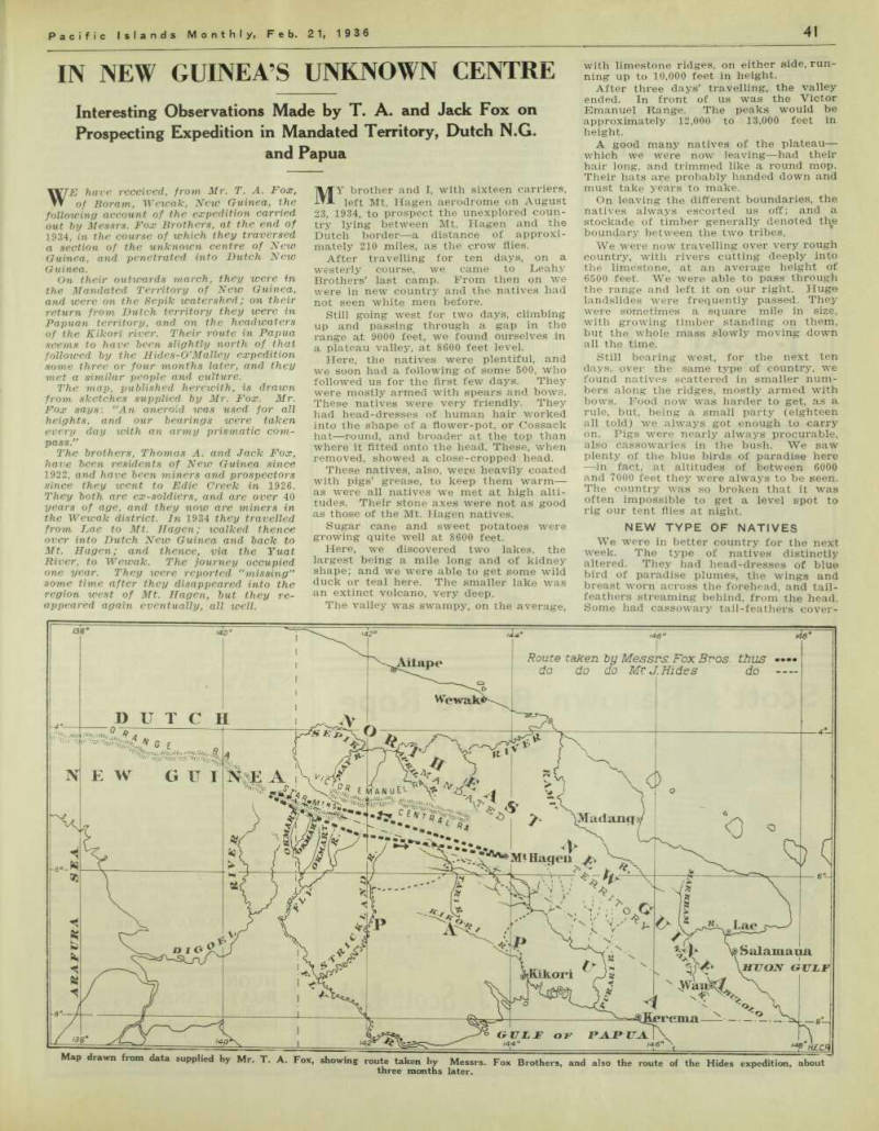
The map, published herewith, is drawn from sketches supplied by Mr. Fox. Mr.
Fox says: “An aneroid was used for all heights, and our bearings were taken every day icith an army prismatic com pass."
The brothers, Thomas A. and Jack Fox, have been residents of New Guinea since 1922, and have been miners and prospectors since they went to Edie Creek in 1926.
They both are ex-soldiers, and are over 40 years of age, and they now are miners in the Wewak district. In 1934 they travelled from Lae to Mt. Hagen; walked thence over into Dutch New Guinea and back to Mt. Hagen; and thence, via the Tuat River, to Wewak. The journey occupied one year. They were reported “missing” some time after they disappeared into the region west of Mt. Hagen, but they re appeared again eventually, all well.
MY brother and I, with sixteen carriers, left Mt. Hagen aerodrome on August 23, 1934, to prospect the unexplored coun try lying between Mt. Hagen and the Dutch border —a distance of approxi mately 210 miles, as the crow flies.
After travelling for ten days, on a westerly course, we came to Leahy Brothers’ last camp. From then on we were in new country and the natives had not seen white men before.
Still going west for two days, climbing up and passing through a gap in the range at 9000 feet, we found ourselves in a plateau valley, at 8600 feet level.
Here, the natives were plentiful, and we soon had a following of some 500, who followed us for the first few days. They were mostly armed with spears and bows.
These natives were very friendly. They had head-dresses of human hair worked into the shape of a flower-pot, or Cossack hat —round, and broader at the top than where it fitted onto the head. These, when removed, showed a close-cropped head.
These natives, also, were heavily coated with pigs’ grease, to keep them warm — as were all natives we met at high alti tudes. Their stone axes were not as good as those of the Mt. Hagen natives.
Sugar cane and sweet potatoes were growing quite well at 8600 feet.
Here, we discovered two lakes, the largest being a mile long and of kidney shape; and we were able to get some wild duck or teal here. The smaller lake was an extinct volcano, very deep.
The valley was swampy, on the average,
with limestone ridges, on either side, run ning up to 10,000 feet in height.
After three days’ travelling, the valley ended. In front of us was the Victor Emanuel Range. The peaks would be approximately 12,000 to 13,000 feet in height, A good many natives of the plateau— which we were now leaving—had their hair long, and trimmed like a round mop.
Their hats are probably handed down and must take years to make.
On leaving the different boundaries, the natives always escorted us off; and a stockade of timber generally denoted boundary between the two tribes.
We were now travelling over very rough country, with rivers cutting deeply into the limestone, at an average height of 6500 feet. We were able to pass through the range and left it on our right. Hugo landslides were frequently passed. They were sometimes a square mile in size, with growing timber standing on them, but the whole mass slowly moving down all the time.
Still bearing west, for the next ten days, over the same type of country, we found natives scattered in smaller num bers along the ridges, mostly armed with bows. Food now was harder to get, as a rule, but, being a small party (eighteen all told) we always got enough to carry on. Pigs were nearly always procurable, also cassowaries in the bush. We saw plenty of the blue birds of paradise here —in fact, at altitudes of between 6000 and 7000 feet they were always to be seen.
The country was so broken that it was often impossible to get a level spot to rig our tent flies at night.
New Type Of Natives
We were in better country for the next week. The type of natives distinctly altered. They had head-dresses of blue bird of paradise plumes, the wings and breast worn across the forehead, and tail feathers streaming behind, from the head.
Some had cassowary tail-feathers cover-
Map drawn from data supplied by Mr. T. A. Fox, showing route taken by Messrs. Fox Brothers, and also the route of the Hides expedition, about three months later.
ing the whole of their heads, like the bus bies of the Guards’ head-dress. Their spears were tipped with the thigh bones of human beings, and thigh-bone daggers were the rule.
Their prisoners of war were fastened on three poles, 12 feet high from the ground, and then made pin-cushions of, by filling them up with arrows and spears.
This was done on a moonlight night, with torch-light procession complete—a sort of tattoo display.
These natives buried their dead in open fibre-plaited and bark coffins. The latter were put on six posts, 6 feet from the ground, with a roof on top. The body was placed in position, with the knees bent, and no wrappings, and left to the blowflies to clean up. In due course, the bones were used for manifold pur poses, but the skulls were collected and arranged in fibre baskets, on either side of the main entrance of the houses, like skull-racks.
For facial decorations, boars’ tusks in verted and upright, fastened to the upper lip like moustaches, were used; also, quills from the cassowary, 8 to 10 inches long, pierced their noses—some upright, but mostly acrosswise.
These natives, especially, seemed to en joy fighting as a pastime, and were of a good figure. I should not be surprised if they were cannibals. But we were
never able to witness any of their feasts.
After travelling for nine days, we came to a swift-running large river, running N.W. To cross this river, we had to drop down to 4000 ft., which was the level of the river bed, from a 7000 ft. ridge, and climb up the other side at 6800 ft. in the same day—showing how deep the rivers and streams cut into the country here.
Slate and quartz were seen here, but no traces of gold in the wash in the river tested.
Up till now, all the rivers crossed flowed into the Sepik River, which drains all the northern watersheds of the ranges we had passed.
The next few days were occupied in going through a gap in the mountains in front, at 8000 ft. We now were in the Star Mountains, a range situated on the place where the three boundaries meet— Dutch, Papuan, and Mandated Territory.
These Star Mountains were also lime stone, with volcanic cone tops; the high est peaks approximately 13,500 ft. Travel ling through this range, we discovered a small lake at 7800 ft.
The country now opened up to a series of small valleys between the ridges of the range, some being 10 to 20 miles long, running in a S.W. course, which we were now travelling. We travelled for two weeks at between 5500 and 7000-feet levels, with the natives still of the same type and customs. Here, all the waters were running on a south-westerly course.
On The Digoel Watershed
We now found the country sloping to lower levels; and, at a 2000-feet level (the level of the valleys in the ranges around us), we found all the streams we passed converged into a large river, flow ing at least eight miles per hour, and 100 yards wide. This river, which we saw at 2000 ft. altitude, was one of the head waters of the Dutch river, the Digoel.
Here, the natives were different again, and wore their own hair, in a bun-shaped knob. They wore possum-teeth necklaces around their necks, and were armed with bows and arrows. These natives spoke to us in the Malay language—that is, some of the words were recognised as Malay—and offered us birds of paradise plumes for our trade. They had stone axes, and evidently had had association with the Dutch-Malay bird-hunters when plumes were of a market value. They did not appear to have seen white men before.
Some wore bird of paradise plumes in their hair, and had bone daggers fastened at the waist. They built their houses on posts 10 feet high, square of shape, with plaited bamboo walls. Here, the sago palm was in all the swamps seen, and pigs were plentiful; but the country was still very ridgy and broken.
We now decided to go back, as Dutch territory was out of bounds to us, and we had no hope of claiming any gold we might find. We had now been travelling for two months, averaging seven miles a day at least, making about 400 miles of country we had traversed to get to the Dutch Border —practically doing double the distance, which is only about 210 miles in a straight line.
Papua Entered
In front of us, and slightly north, the Orange Range of Mountains loomed up in the skyline. Some of the peaks we esti
mated were at least 15.000 feet high.
These mountains were the highest we saw on the whole trip.
On October 23 we started to return, via the Papuan border, so as to prospect the head waters on the southern fall of the ranges passed on the way out.
We now proceeded up one of the arms of the Digoel River on a south-easterly course, and climbed up to 6000 and 7000 feet. Here, the natives were similar to the natives of the higher levels. We were able to go for about 100 miles, along a series of small valleys, in a south-easterly direction.
A huge limestone wall flanked us on the right. In some places, 2000 feet of sheer wall was seen. This wall ran for over 100 miles, with gaps cut through by the rivers, which now were running in a more south erly direction. Here, we found some fossils (shells) in a dry creek bed, but no traces of gold.
The natives here wore a crescent shape head-dress of human hair, with the peaks turning up; and they decorated the head-piece with small flowers, yellow and mauve. Others worked silver leaves, also red leaves, in a W shape across the front of the head-piece. The custom of disposing of their dead in the open, on six posts in an open box, was still the rule.
Natives’ Underground Roads
Their gardens were surrounded with a system of deep trenches; 10 feet deep and 12 ft. in width, with wild cane growing and overlapping the trench, making them almost tunnels, and almost dark inside.
The tunnels were used as roads, and also to keep the pigs out of the gardens on top. Some were over 400 yards long, with cross-saps coming in at right angles, and
the whole village was connected up this way. These trenches were dug out with wooden spades; mostly in clay, with a volcanic top soil.
We did not see any natives use boiling water on the whole trip, or any signs of pots. All cooking was done on hot stones, or in bamboos; and the steam from our tea billy always had them amazed. Water was used for drinking purposes only. Dry cleaning was the fashion everywhere: but the pigs’ grease, rubbed into their skins, did not give this system a fair trial! Also, they daubed their faces with red or white clay.
We now came to a waterfall of some 300 or 400 feet fall. Here, the natives called the swift-flowing river the Okmart.
That seemed to be the name for the many rivers we had passed since leaving the Digoel waters, suggesting that the head waters of the Fly and Strickland Rivers arise in the Mandated Territory.
We were now passing through the high country that Messrs. Hides and O’Malley skirted some four months later.
In most cases, the natives had rope bridges over the rivers. We crossed some which were 100 feet long, and a drop of anything from 50 to 100 feet was common.
To slip into these fast-running torrents meant “Good night, nurse!” and one at a time was the strict rule.
We now took a more easterly course, climbing up over a gap or saddle in the mountains at 9400 ft. Here we had a hail storm. The stones were the size of marbles, and they made the ground white for over four hours. In sheltered places, it lay about for over 24 hours.
For two days, we were travelling in a small valley at 9000 feet —swampy going— no natives lived there —only tracks were
seen. Here we had to exist on what food reserves Ave carried from our last camp, where we left the natives at 7200 ft.
We passed between and quite close to three mountains. The one on our right was all of 14,000 ft. in height, and white with hail-stones at the time of our pass ing, as also were the two peaks on our right, about 13,0i0ft. high.
On the third day, we came on to natives at 8400 ft., and were able to get potatoes, cane, and a pig. The natives were still of the same type.
For the next 60 miles, we travelled mostly at 8000 ft., passing one river which ran underground for half a mile before reappearing from the limestone. The country was now more volcanic, and the waters were the headwaters of the Kikori, which reach back into the Mandated Territory, as does the Purari. All these waters were fast-running torrents.
The natives here were using more spears as arms, similar to the Mt. Hagen type of natives. Their stone axes were better made.
The Crags: 13,500 Feet
After two weeks’ travelling, through similar country, mostly at 6500 feet levels, we sighted, in front and slightly north, the Crags, a mountain that can be seen from Mt. Hagen. This we recognised by its shape; it is 13,500 ft. high. We now knew we had about 100 miles to go to get back home.
After a few days more at 6500 ft., we climbed over a ridge at 9200 ft., and were able to work along a course slightly N.E.. thus approaching the Crags in a more or less direct line. We came upon natives with steel axes, worn down to the hubs.
These axes were of an old-fashioned type, and were traded-in by stages from tribe to tribe, from the coast back, as they were worn out and the original owners got better ones.
These natives had not seen white men before, and in no way were civilised.
Some had hair or fibre nets over their heads; also, bark belts were beginning to appear as we approached the Crags. But, as yet, they did not understand Mt. Hagen talk when used to them.
Here we found a small lake, at 8200 ft., also the longest house on the whole trip— some 130 yards long.
After a few days, we passed round the Crags: and, after a week’s going, over country that the Leahy Brothers had been in before, we arrived at Mt. Hagen aero drome, on December 15, 1934, all in good health and with the party (boys and our selves) complete.
We had now completed a trip to the Dutch border and back, in which we had to traverse over 800 miles of new country (the mountainous character of the country making much extra walking necessary); and we also always had to keep in touch with the natives for food supplies. We had travelled along the “roof” of New Guinea —on the northern watershed on the way out, thus crossing and prospecting the headwaters of the numerous rivers emptying into the Sepik River; and returning on the southern watershed, from the Digoel headwaters, in Dutch New Guinea, and crossing the headwaters of the Fly, Strickland, and Kikori Rivers on our return trip.
We did not find any traces of gold in the country explored, and very little mineralisation. Volcanic eruptions through the limestone belts were the rule.
The population of natives in the area traversed was estimated at 100,000. • For 3i months we lived entirely on the country, carrying only tea and salt, and a universal “trade.” Being a small party it was possible to do this on this trip.
The natives always had sweet potatoes, sugar-cane, and pigs.
Heavy timber was the rule at all heights; and the natives ring-barked ex tensively. There was grass in the larger valleys, in the lower altitudes.
The natives, as a rule, were quite easy to get on with, and simple to understand.