Charting Stewart Island
pp. 53-54 · Read in the full issue
Yachting
Pictures and Text by SALLY ANDREW
In the Ha’apai group of central Tonga, Kiwi yacht Ayla anchored beside us. Although we were sharing a warm trop ical island with waving palms and white sandy beaches, Ayla’s crew waxed poetic about the isolation, the hiking, the magnificence of New Zealand’s far south.
This was all it took. I decided I was sail ing to Stewart Island. My husband told me I was nuts. “Nobody goes there. It’s too cold. It’s too windy. It’s too remote. It’s 47 degrees south of the equator!” It’s uncrowded and wild!” I countered.
Alan hastily sketched details of a few anchorages, including his secret fishing spots while wife Liz jotted down details of harbours along New Zealand’s east coast.
The information proved extremely useful. I didn’t realise that most navigational charts of Stewart Island waters date from 1849 when surveys were carried out by Captain J L Stokes on the HMS Acheron. Even
today, charts of Port Adventure, Lords River and Port Pegasus show only a few soundings and a roughly sketched coast line. Topographical maps give a more real istic portrayal of bays and coves.
We sailed to Stewart Island and spent three summers mapping our favourite anchorage and hiking trails. Last year, with the collaboration of Peter Foster, New Zealand writer and sailor, the first Cruising Guide to Stewart Island was published. It is available through the Mana Cruising Club in Wellington.
Stewart Island is popular with people who enjoy a natural environment. Though remote, the journey across Foveaux Strait by plane or the Foveaux Express ferry is easy. To arrive safely by yacht, however, requires patience, determination and the ability to interpret weather information: Our recent trip south was a prime example “Quite spasmodic, but rude when they arrive.” This was how one fisherman described the southern ocean swell.
Though conditions were overcast and
calm, an impudent sea indicated that more wind was on the way.
During the next few days, all of New Zealand from Cook Strait south was affect ed by gales. We were safely anchored in front of Carey’s Bay Pub at Port Chalmers in Dunedin. Although it was mid-summer, the air temperature hit a brisk five degrees one morning. Oh well, I sighed. This was once the embarkation point for several Antarctic expeditions, including Captain Scott in 1901 and 1910. The chill added ambiance.
We finally decided we’d waited long enough. Winds had lightened and, besides, the weather reports hadn’t been right in six weeks, why should we believe them now?
At midnight the local coast station reported “light south easterlies” and that’s what we got - all the way to the southeast tip of the South Island. We arrived at Nuggets at dusk and dropped our hook under the high headland near the lighthouse.
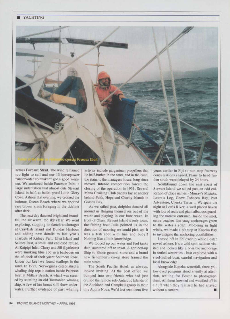
After a few hours of sleep we weighed anchor. The auto pilot broke shortly after dawn forcing us to tediously hand steer
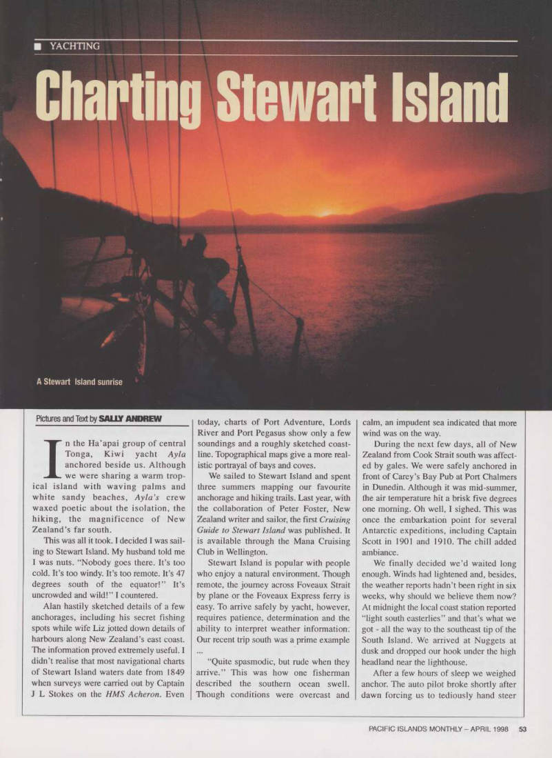
A Stewart Island sunrise
across Foveaux Strait. The wind remained too light to sail and our 13 horsepower “underwater spinnaker” got a good work out. We anchored inside Paterson Inlet, a large indentation that almost cuts Stewart Island in half, at bullet-proof Little Glory Cove. Ashore that evening, we crossed the isthmus Ocean Beach where we spotted rare brown kiwis foraging in the tideline after dark.
The next day dawned bright and beauti ful, the air warm, the sky clear. We went
exploring, stopping to sketch anchorages
at Crayfish Island and Dundas Harbour and adding new details to last year’s chartlets of Kidney Fern, Ulva Island and Sailors Rest, a small and enclosed refuge.
At Kaipipi Inlet, Clarry and Jill (Lyttleton) were smoking blue cod in a barbecue on the aft-deck of their yacht Southern Rose.
Under our keel we found scallops in the sand. In 1925, Norwegians established a whaling ship repair station inside Paterson Inlet at Millars Beach. A wharf was creat ed by scuttling an old Tasmanian whaling ship. A few of her bones still show under water. Further evidence of past whaling
activity include gargantuan propellers that lie half-buried in the sand, and in the bush, the stairs to the managers house, long since moved. Intense competition forced the closing of the operation in 1931. Several Mana Cruising Club yachts lay at anchor behind Faith, Hope and Charity Islands in
Golden Bay.
As we sailed past, dolphins danced all around us flinging themselves out of the water and playing in our bow wave. In front of Oban, Stewart Island’s only town, the fishing boat Julia pointed us in the direction of mooring we could pick up. It was a fish spot with line and buoy!!
Nothing like a little knowledge.
We topped up our water and fuel tanks then sauntered off to town. A spruced-up Ship to Shore general store and a brand new fishermen’s co-op store framed the main street.
The South Pacific Hotel, as always, looked inviting. At the post office we bumped into two friends who had just cruised the remote sub-Antarctic Islands of the Auckland and Campbell group in their tiny Aquila Nova. We’d last seen them five
years earlier in Fiji so non-stop fourway conversations ensued. Plans to head fur ther south were delayed by 24 hours.
Southbound down the east coast of Stewart Island we sailed past an odd col lection of place names - Murray’s Mistake, Laura’s Leg, Chew Tobacco Bay, Port Adventure, Cheeky Tartar ... We spent the night at Lords River, a well placed haven with lots of seals and giant albatross guard ing the narrow entrance. Inside the inlet, ochre beaches line snug anchorages green to the water’s edge. Motoring in light winds, we made a pit stop at Kopeka Bay to investigate the anchoring possibilities.
I stood off in Fellowship while Foster rowed ashore. It’s a wild spot, seldom vis ited and looked like a possible anchorage in settled westerlies - best explored with a steel-hulled boat, careful navigation and
local knowledge.
Alongside Kopeka waterfall, three yel low-eyed penguins stood silently at atten tion, waiting for Foster to photograph them. All three frowned and waddled off in a huff when they realised he had arrived without a camera. ■
Foser at the helin as feltowsnip crosses Foveaux Strait