From poverty to plenty
pp. 54-55 · Read in the full issue
Yachting
Story and photography by SALLY ANDREW
Our parting impression of
Poverty Bay was of early
morning light dancing on Young Nick’s Head. This white-cliffed headland was named for Captain Cook’s cabin boy Nicholas Young, the first person on board the Endeavour to sight New Zealand in October 1769. The Maori had already named the headland Te Kuri o Paoa - Paoa’s dog - because it looks like a
crouching dog watching the sunrise.
Fellowship was bound for the Bay of Plenty, sailing north along Tairawhiti, the coast upon which the sun shines across the water. This eastern region of New Zealand’s North Island is the ancestral land of Maori who arrived in Aotearoa centuries before Captain Cook. Maori history and culture thrive in the area and local tradition tells how the first settlers arrived in the region in two big sailing canoes - the descendants of those in the waka Horouta settling north of Gisborne, and those of the waka Takitimu to the south. Today, tiny Maori communities dot a coastline characterised by bare hills, bush-fringed coves and long empty beaches.
Hugging the coast we sailed past Wainui Beach where, in 1970, a pod of 59 sperm whales beached themselves and Whangara where legendary Maori explorer Paikea arrived after travelling to New Zealand on the back of a whale. We anchored for a night at Tolaga Bay. Captain James Cook spent six days at Tolaga repairing the Endeavour and taking on water and supplies. The most east erly cape in New Zealand is feared and respected by most mariners, and has earned its reputation. Adverse currents, offshore shoals, wicked weather - East Cape sticks out into the path of tropical cyclones and snags antarctic depressions, creating treach erous sailing conditions.
I stood watch as we went by, scared because the bright beam from the lighthouse looked too close. East Cape Lighthouse, built in 1906, stands 154 metres above sea-level and can be seen far out to sea. Using a GPS, depth sounder and chart, I knew we were a safe distance offshore, given the weather conditions, but I plotted our position every
15 minutes anyway to ease my worried mind.
Unfortunately, navigation at night can make you seasick really quickly. At sunrise we rounded Cape Runaway, named Whagaparoa by the Maori, where two legendary canoes the Tainui and the Arawa landed. This cape marks the beginning of New Zealand’s ther mally active Bay of Plenty which captain Cook named after the abundant supplies of food he found there.
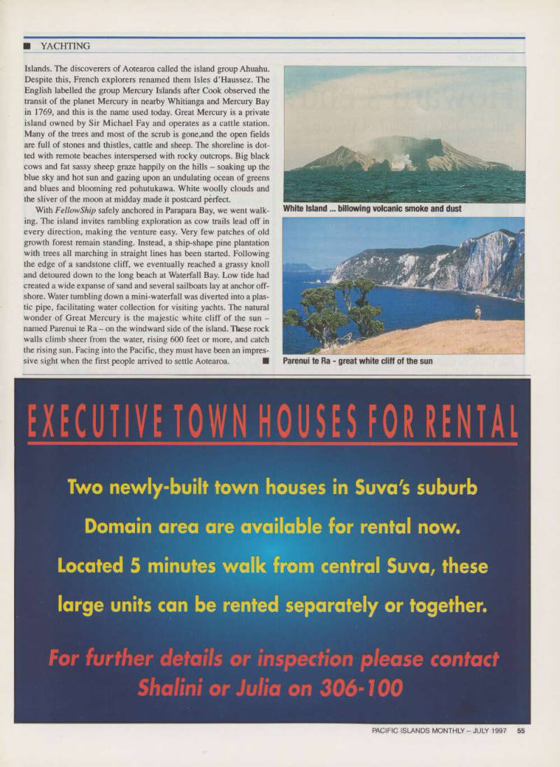
By mid-moming White Island lay off our bow, smoke billowing out of her belly. We gave the island a wide berth and stayed
upwind, avoiding the possibility of an
untimely and dangerous belch - the deposit of a mud plop would be capable of bringing down our rig and/or sinking us. White Island is New Zealand’s only active volcanic island.
The imposing show of power and moonscape surface evince images of the dynamic forces involved in the creation of the earth.
Fellowship continued running downwind
to Mayor Island, an unspoilt bush-covered island with two volcanic lakes and masses of native birds. The southeasterly wind was blowing right into South East Bay, where a beach resort nestles amongst huge pohutakawa trees and obsidian cliffs. So we anchored in the lee in a snug little cove called Northwest Bay.
What a beautiful spot. Wide black bands of obsidian streak the island’s geologic struc ture, glittering in the sun like glass. Above the high tide line, fresh water flows out of hot springs on the beach. We dug a hole in the sand and luxuriated in a warm bath, gaz ing out at Fellowship tugging at her anchor.
When the pool collapsed, we’d refortify it with rocks and sand, let it fill with clear warm water and climb back in. Just what the doctor ordered after a long sail. When the wind shifted, so did we, over to the Mercury
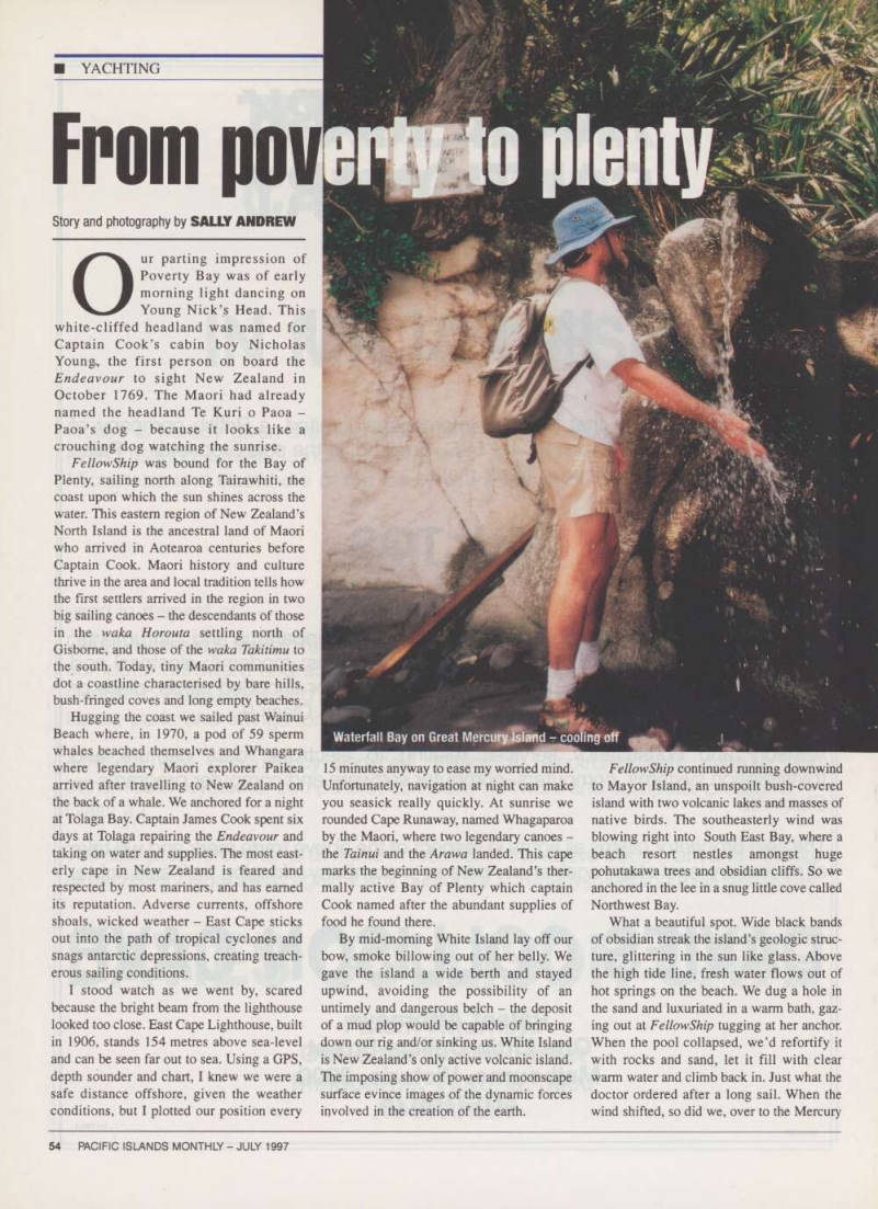
Waterfall Bay on Great Mercury Island - cooling off
Islands. The discoverers of Aotearoa called the island group Ahuahu.
Despite this, French explorers renamed them Isles d’Haussez. The English labelled the group Mercury Islands after Cook observed the transit of the planet Mercury in nearby Whitianga and Mercury Bay in 1769, and this is the name used today. Great Mercury is a private island owned by Sir Michael Fay and operates as a cattle station.
Many of the trees and most of the scrub is gone,and the open fields are full of stones and thistles, cattle and sheep. The shoreline is dot ted with remote beaches interspersed with rocky outcrops. Big black cows and fat sassy sheep graze happily on the hills - soaking up the blue sky and hot sun and gazing upon an undulating ocean of greens and blues and blooming red pohutukawa. White woolly clouds and the sliver of the moon at midday made it postcard perfect.
With Fellowship safely anchored in Parapara Bay, we went walk ing. The island invites rambling exploration as cow trails lead off in every direction, making the venture easy. Very few patches of old growth forest remain standing. Instead, a ship-shape pine plantation with trees all marching in straight lines has been started. Following the edge of a sandstone cliff, we eventually reached a grassy knoll and detoured down to the long beach at Waterfall Bay. Low tide had created a wide expanse of sand and several sailboats lay at anchor off shore. Water tumbling down a mini-waterfall was diverted into a plas tic pipe, facilitating water collection for visiting yachts. The natural wonder of Great Mercury is the majestic white cliff of the sun named Parenui te Ra - on the windward side of the island. These rock walls climb sheer from the water, rising 600 feet or more, and catch the rising sun. Facing into the Pacific, they must have been an impres sive sight when the first people arrived to settle Aotearoa. ■
White Island... billowing volcanic smoke and dust
Parenui te Ra - great white cliff of the sun