The Path Of
p. 115 · Read in the full issue
A Hurricane
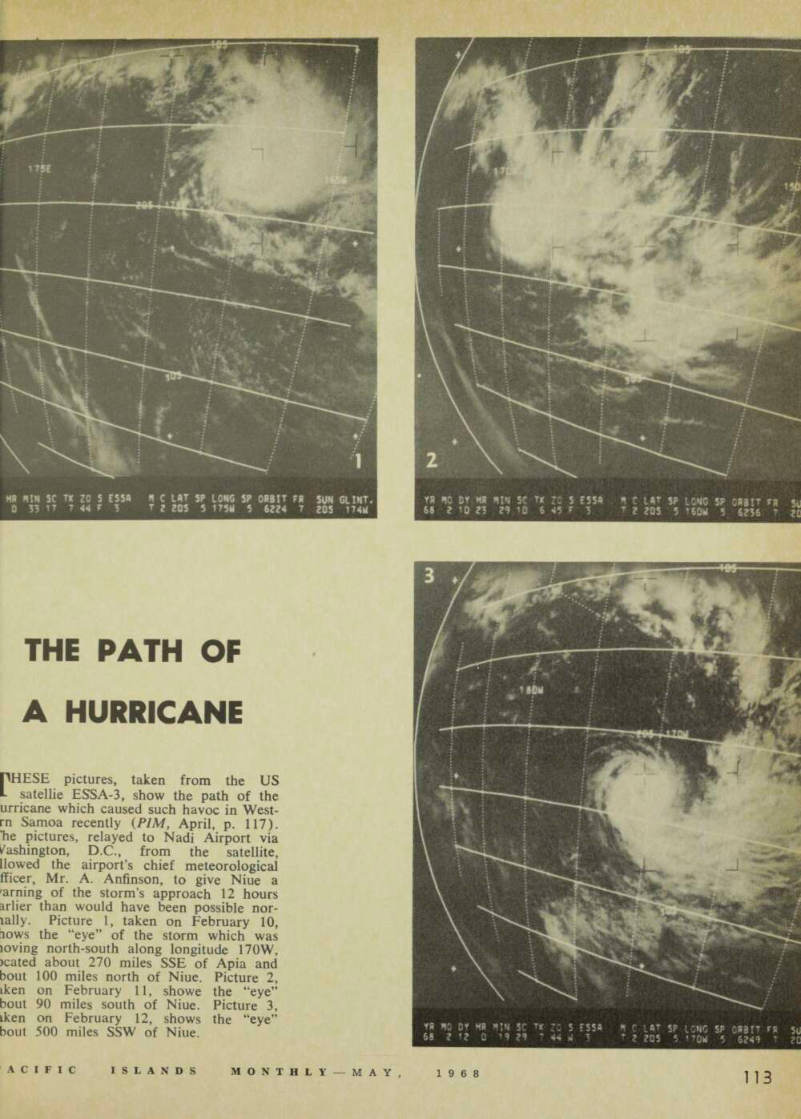
CHESE pictures, taken from the US satellie ESSA-3, show the path of the urricane which caused such havoc in West rn Samoa recently ( PIM, April, p. 117).
'he pictures, relayed to Nadi Airport via /ashington, D.C., from the satellite, [lowed the airport’s chief meteorological fficer, Mr. A. Anfinson, to give Niue a earning of the storm’s approach 12 hours arlier than would have been possible nor xally. Picture 1, taken on February 10, iows the “eye” of the storm which was loving north-south along longitude 170 W, >cated about 270 miles SSE of Apia and bout 100 miles north of Niue. Picture 2, iken on February 11, showe the “eye” bout 90 miles south of Niue. Picture 3, iken on February 12, shows the “eye” bout 500 miles SSW of Niue.