The Pacific Picture: Droughts,
pp. 23-24 · Read in the full issue
Just a Crazy, Mixed Up Kid
Hurricanes, Erupting Volcanoes
In the Pacific in December, Nature got the bit between her teeth and gave the Islands some hurry-up.
NEARLY everyone was complain ing of the long spells of hot weather, hotter and longer than usual. In some islands, drought was threatening, as it was on the east coast of Australia.
In New Caledonia the drought was a problem to the cattle in dustry, w'hose position was stated to be “grave”, and in the western Solomons they were saying it was as bad there as anyone could re member.
Volcano
THE district of Madang has
more than its share of vol canoes in its 19,000 square miles
of territory (half of it ocean).
Occasionally a volcano —they are mostly on the off-shore islands — will explode into life with more
ferocity than usual and plans will be made to evacuate the native populations to the mainland.
But the evacuation is seldom got under way, because the volcano has by this time settled down again.
In December, the 4,000-ft volcano on small, fertile Manam Island re fused to settle down after showering the island with stones, pumice and ash, destroying the native food gardens.
Result: The 3,800 islanders were moved off in a fleet of small boats, and set up in villages up and down a 45-mile stretch of mainland coast.
They look like staying there for a few months.
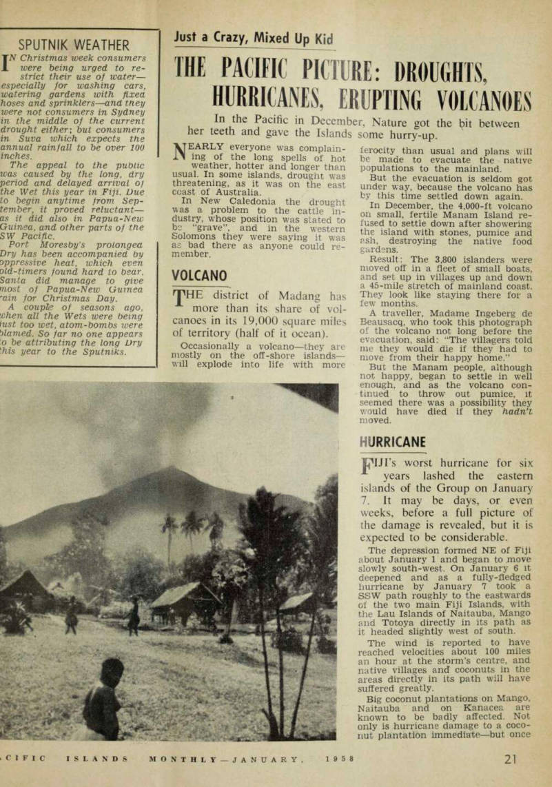
A traveller, Madame Ingeberg de Beausacq, who took this photograph of the volcano not long before the evacuation, said: “The villagers told me they would die if they had to move from their happy home.”
But the Manam people, although not happy, began to settle in well enough, and as the volcano con tinued to throw out pumice, it seemed there was a possibility they would have died if they hadn't moved.
Hurrone
purs worst hurricane for six years lashed the eastern islands of the Group on January 7. It may be days, or even weeks, before a full picture of the damage is revealed, but it is expected to be considerable.
The depression formed NE of Fiji about January 1 and began to move slowly south-west. On January 6 it deepened and as a fully-fledged hurricane by January 7 took a SSW path roughly to the eastwards of the two main Fiji Islands, with the Lau Islands of Naitauba, Mango and Totoya directly in its path as it headed slightly west of south.
The wind is reported to have reached velocities about 100 miles an hour at the storm’s centre, and native villages and coconuts in the areas directly in its path will have suffered greatly.
Big coconut plantations on Mango, Naitauba and on Kanacea are known to be badly affected. Not only is hurricane damage to a coco nut plantation immediate —but once
a coconut tree has lost fronds it will not bear again until these are made good. Loss of production from hurricane-damaged plantations lasts months and sometimes years.
Winds of 50 miles an hour were felt in Suva; an Orient cruise ship had to take shelter to the west of Viti Levu; RNZAF flying-boats went to New Zealand for safety and in ternational airlines suspended ser vices until the storm had passed to the southward. But Viti Levu— including Suva, which with the Yasawas took the brunt of the last hurricane in 1952, missed the worst of the latest blow.
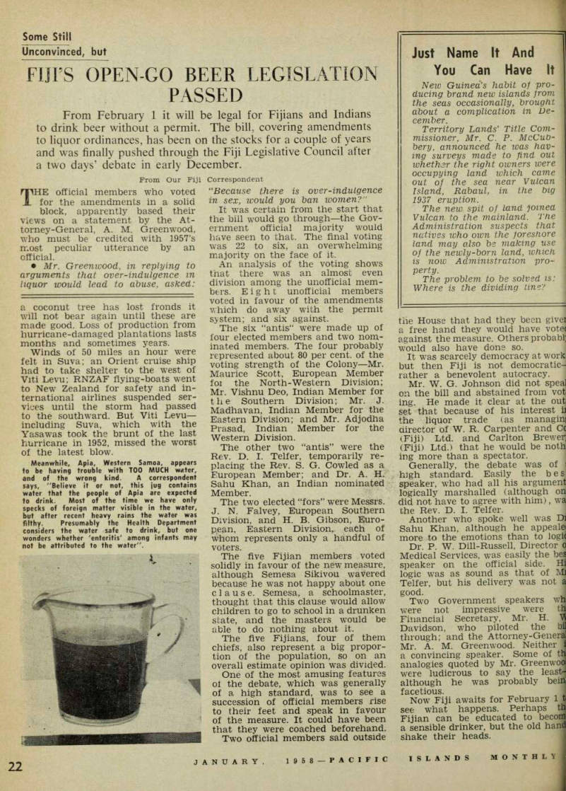
Meanwhile, Apia, Western Samoa, appears to be having trouble with TOO MUCH water, and of the wrong kind. A correspondent says, "Believe it or not, this jug contains wafer that the people of Apia are expected to drink. Most of the time we have only specks of foreign matter visible in the water, but after recent heavy rains the water was filthy. Presumably the Health Department considers the water safe to drink, but one wonders whether 'enteritis' among infants may not be attributed to the water".