Anglo-American Lake
pp. 9-10 · Read in the full issue
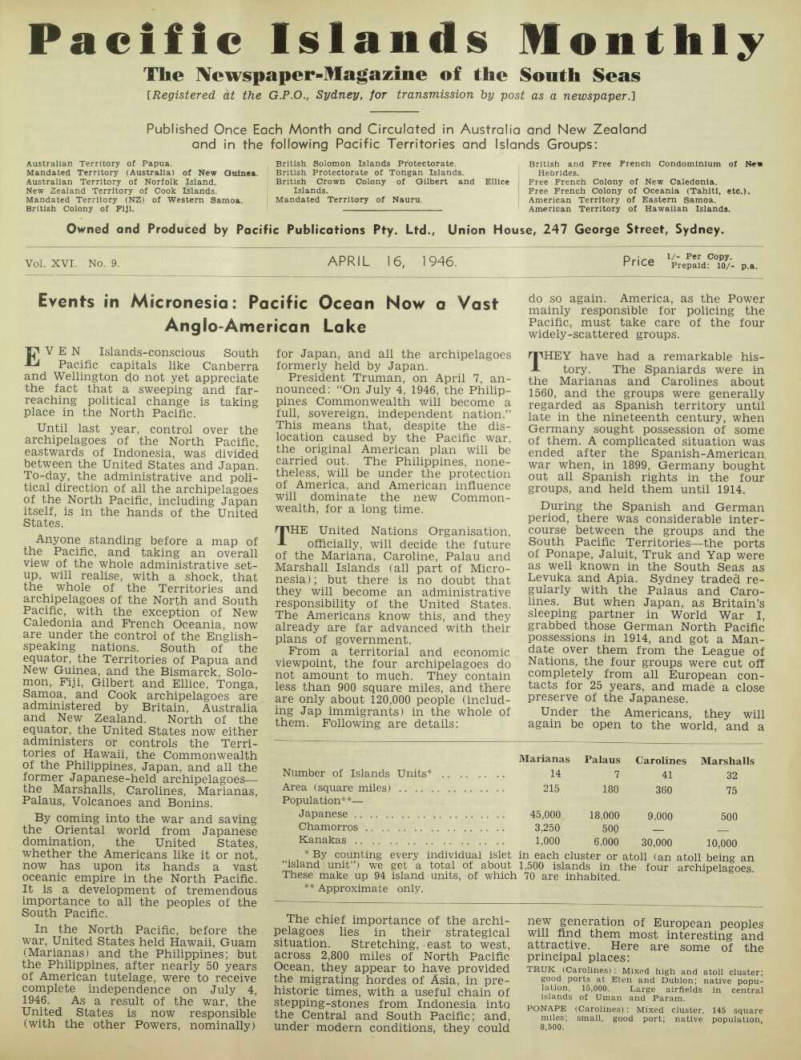
Events in Micronesia: Pacific Ocean Now a Vast Anglo-American Lake
EVEN Islands-conscious South Pacific capitals like Canberra and Wellington do not yet appreciate the fact that a sweeping and far reaching political change is taking place in the North Pacific.
Until last year, control over the archipelagoes of the North Pacific, eastwards of Indonesia, was divided between the United States and Japan.
To-day, the administrative and poli tical direction of all the archipelagoes of the North Pacific, including Japan itself, is in the hands of the United States.
Anyone standing before a map of the Pacific, and taking an overall view of the whole administrative set up, will realise, with a shock, that the whole of the Territories and archipelagoes of the North and South Pacific, with the exception of New Caledonia and French Oceania, now are under the control of the English speaking nations. South of the equator, the Territories of Papua and New Guinea, and the Bismarck, Solo mon, Fiji, Gilbert and Ellice, Tonga, Samoa, and Cook archipelagoes are administered by Britain, Australia and New Zealand. North of the equator, the United States now either administers or controls the Terri tories of Hawaii, the Commonwealth of the Philippines, Japan, and all the former Japanese-held archipelagoes— the Marshalls, Carolines, Marianas, Palaus, Volcanoes and Bonins.
By coming into the war and saving the Oriental world from Japanese domination, the United States, whether the Americans like it or not, now has upon its hands a vast oceanic empire in the North Pacific.
It is a development of tremendous importance to all the peoples of the South Pacific.
In the North Pacific, before the war, United States held Hawaii, Guam (Marianas) and the Philippines; but the Philippines, after nearly 50 years of American tutelage, were to receive complete independence on July 4, 1946. As a result of the war, the United States is now responsible (with the other Powers, nominally)
for Japan, and all the archipelagoes formerly held by Japan.
President Truman, on April 7, announced: “On July 4 1946, the Philippines Commonwealth will become a full, sovereign, independent nation.’
This means that, despite the dislocation caused by the Pacific war, the original American plan will be carried out The Philippines, nonetheless, will be under the protection of Amenca, and American influence will dominate the new Commonwealth, for a long time.
THE United Nations Organisation, officially, will decide the future of the Mariana, Caroline, Palau and Marshall Islands (all part of Micronesia); but there is no doubt that they will become an administrative responsibility of the United States, The Americans know this, and they already are far advanced with their plans of government.
From a territorial and economic viewpoint, the four archipelagoes do not amount to much. They contain less than 900 square miles, and there are only about 120,000 people (including Jap immigrants) in the whole of them. Following are details:
The chief importance of the archipelagoes lies in their strategical situation. Stretching, east to west, across 2,800 miles of North Pacific Ocean, they appear to have provided the migrating hordes of Asia, in pre- Wi p th a T Se i Ul C^ ain ? f ?h?r^? neS rf fr O om f h n o° n - e fl Sla lnt „° the Central and South Pacific, and, under modern conditions, they could
do so again. America, as the Power mainly responsible for policing the Pacific, must take care of the four widely-scattered groups.
THEY have had a remarkable his tory. The Spaniards were in the Marianas and Carolines about 1560, and the groups were generally regarded as Spanish territory until late in the nineteenth century, when Germany sought possession of some of them. A complicated situation was ended after the Spanish-American, war when, in 1899, Germany bought out all Spanish rights in the four groups, and held them until 1914.
During the Spanish and German period, there was considerable inter course between the groups and the South Pacific Territories—the ports of Ponape, Jaluit, Truk and Yap were as well known in the South Seas as Levuka and Apia. Sydney traded re gularly with the Palaus and Caro lines. But when Japan, as Britain’s sleeping partner in World War I, grabbed those German North Pacific possessions in 1914, and got a Man date over them from the League of Nations, the four groups were cut off completely from all European con tacts for 25 years, and made a close preserve of the Japanese.
Under the Americans, they will again be open to the world, and a
new generation of European peoples
will find them most interesting and attractive. Here are some of the
principal places:
TRUK (Carolines); Mixed high and atoll cluster; g° od ports at Eten and Dublon; native popu “ "’“-an anTparim eldS ‘ n Cen ‘ ra ' PONAPE (Caroline.,: Mixed cluster, 145 square miles; small, good port; native population, 8 - s °o-
Marianas Palaus Carolines Marshalls Number of Islands Units* 14 7 41 32 Area (square miles) 215 180 360 75 Population**— Japanese 45,000 18,000 9,000 500 Chamorros 3,250 500 Kanakas 1,000 6,000 30,000 10,000 * By counting every individual islet in each cluster or atoll (an atoll being an “island unit”) we get a total of about 1,500 islands in the four archipelagoes.
These make up 94 island units, of which 70 are inhabited. ** Approximate only.
PALAU (Palaus): Mixed and low cluster; good port (Koror); administrative centre of whole Mandate; native population, 6,500. Another port, Angaur, in south of cluster.
SAIPAN (Marianas); High island of 72 square miles; fine airfields but only small, artificial port; large Jap population and 3,500 natives.
YAP (Carolines): Cluster of high and low islands; 84 square miles small but fairly good harbour at Colonia; native population, 6,000.
JALUIT (Marshalls): Atoll cluster, 3 square miles; safe anchorage in lagoon at Jabur; native population, 2,000.
KUSAIE (Carolines): High island, 45 square miles; two small good harbours; native popu lation, 1,200.
THE native people of the four groups present no particular problem.
Meeting their fourth set of over-lords in 50 years—they already have been governed by Spaniards, Germans and Japanese—they are not likely to resent new guardians; and the Americans, following their usual policy, will seek to educate them and quickly lift their standards of life.
Under the Japanese Governmental system (which followed the German model) the archipelagoes were divided into six administrative districts, the headquarters of which were: Palau (also Mandate headquarters), Saipan, Yap, Truk, Ponape, and Jaluit—with secondary headquarters at Kusaie and Tinian.
The Americans retained control of Guam (in the Marianas) after the war with Spain, and have a credit able establishment there; and it is expected that Guam, instead of Koror (in the Palaus) will be the head quarters of the United States Adminis tration, which also may embrace the Bonin and Volcano groups, and Wake and Marcus Islands.
The chief problems will be two — transport and languages. The use of planes, however, will greatly simplify the task of maintaining communi cations over the very widely scattered archipelagoes.
There are several different lan guages. The Japs tried to overcome this difficulty by making Japanese language compulsory, and most of the younger generation speak some Japanese. A good many of the older Islanders already speak either Eng lish, Spanish or German; and it is likely that the new education system will make English the lingua franca.
The Japanese immigrants are a problem. As soon as Japan got the Mandate, she proceeded to plant Japanese sugar-growing communities in the groups, especially in the Marianas, and when war came there were between 70,000 and 100,000 Japs settled there. The Americans have given no indication of what they in tend to do with these people— whether they will repatriate them, or will try to make good American citizens of them, after the model of the 150,000 Japs in Hawaii.
As to their Governmental pro cedure, it may be taken as certain that the Americans will try to develop competent native personnel. They will find both the Chamorros (a Malayan-Melanesian mixture, now carrying a heavy strain of Spanish) and the Kanakas (Micronesians, with strong Indonesian influences) very
adaptable, in this respect. They also may be assisted by examining the system alongside the Marshalls, in the Gilberts, where the British have been very successful in teaching the Gilbertese (Micronesians) to govern themselves.
THERE have been many indications that America’s new and ex tended interest in the Pacific Islands generally is going to be very good for Pacific production and trade.
The Americans already are reach ing out into the Pacific after raw materials—within the past month, American inquiries for shell suitable for button-making (formerly a mono poly of Japan and Czecho-slovakia) and for vanilla beans have come through this office.
The Americans, of course, will be inclined to give first thought to the economic development of their own territories north of the equator; but the South Pacific Territories may ex pect also to benefit increasingly as transport improves—especially it the Anglo-American loan is approved by Congress next month.
IT is evident that, preparatory to the establishment of the new American Administration north of the equator, discussions have been going on between the British Govern ment and the United States.
A Western Pacific High Commission Gazette, issued in Suva on January 25, announced that the name of the Fanning Island district of the Gilbert and Ellice Islands Colony had been altered to “Line Islands District,” which now comprises Fanning, Christ mas and Washington Islands.
In the old days, prior to the Japa nese expansion, the islands lying along the equator, from the Palaus, in the west, right across to Christmas Island, in the east, were loosely called the Line Islands. In recent years, there has been a tendency, especially by American writers, to call all the scattered, unimportant atolls east ward of the Gilberts the Line Islands.
ON March 14, some of the Australian newspapers, under excited head ings, announced that “talks are now going on in Washington on American claims for 25 British and New Zealand islands in the Central Pacific as strategic bases.” This certainly seemed startling; but when one examined the report, it was found that “the 25 islands over which the United States has asked Britain and New Zealand to surrender sovereignty” were as follow: British: Canton, Enderbury, Phoenix, Christmas, Birnie, McKean, Gardner, Hull, Sydnev, Carondelet Reef, Maiden, Starbuck, Nokufetau, Funafuti, Nukulae lae, Vostock, Caroline and Flint.
New Zealand: Atafu, Nukunono, Fakaofo, Tongareva, Rakahanga, Mani hiki, Danger.
If a line is drawn around all the islands named, we can see a large oval, lying along the equator, and including the three most southerly Ellice, the Union or Tokelau group (now attached to Samoa), the Phoenix
group (now attached to the Gilbert and Ellice Colony), the most northerly Cooks (a Territory of New Zealand), and a number of isolated outliers lying northwards of French Oceania.
Except for the Tokelaus (1,388 people) and two Ellice islands (less than 1,000), there are not more than a score or two of people on all the 25 islands; and, economically, they are not worth a packet of biscuits.
Their administration always has been a headache for Britain and New Zealand, and the maintenance of communications has been an ap parently endless expense. They may have some value in the future, in connection with trans-Pacific avia tion. Otherwise, Suva and Wellington officials should be only too glad to hand them over to the Americans.
The Americans, apparently, being obliged to take charge of all the Palau, Caroline and Marshall Islands, stretching along some 3,000 miles of the equator, propose to bring their police organisation still further east wards along the equator, as those atolls extend; and this would supply a reason for the discussions in Wash ington, and the newspaper talk about “strategic bases.”
A glance at the map shows that these uninhabited and economically useless atolls could have considerable strategical importance in the defence of North America and the Panama Canal against Asia.
It would be a comforting thing for the white communities in the South Pacific if the line represented by all those equatorial islands, from Palau, in the west, right across to the Vos tock and Flint sandbanks, in the east, were held by the United States.